Tuesday 27 July 2021

AI’s changing story on infiltration rates leads to ANOTHER flood mitigation issue

According to this article from South Africa, groundwater is "the saviour we need to take care of":

Dr Lukas says because groundwater is something that cannot be seen by the naked eye, the general public has many misconceptions about groundwater. Some people think that you can drill a hole just anywhere and that you will find water, others believe that water flows in underground rivers. It generally moves very slowly, only a few meters per year. 
A few metres per year is what Professor Brassington says too, for the geology underlying Straitgate Farm, in the unsaturated zone, the zone above the water table, the zone into which the flood mitigation trenches would be dug: 
According to Wang et al (2012) the unsaturated zone velocity for the Sherwood Sandstone Group falls in the range 0.6 – 2.3 m/year with a mean of 1.06 m/year
This is all about the hydraulic conductivity. As Professor Brassington explains, hydraulic conductivity is: 
A measure of the rate that water can flow through an aquifer. Often taken to mean permeability with respect to water. The term normally is applied to saturated hydraulic conductivity. Unsaturated hydraulic conductivity has a smaller value and applies only to the unsaturated zone.
The rate at which water infiltrates into the soil, into the unsaturated or vadose zone, is dependent upon the hydraulic conductivity
Hydraulic conductivity is a property of the soil, whether it is the (highly varying) hydraulic conductivity in the unsaturated zone or the saturated hydraulic conductivity in the saturated zone. The infiltration rate generally is a flux which depends on the hydraulic conductivity, but also on other variables and parameters such as the wetness of the soil, land use/ land cover, slope, crust formation etc.. Water movement in the vadose zone also is dependent on the hydraulic conductivity and linked to the infiltration rate, but not the same. The infiltration rate is the inflow into the soil, where the water movement in the vadose zone is the flow inside the soil.
Away from the real world, however, Aggregate Industries’ consultants have come up with an alternative story for how water moves through the unsaturated ground – a story that conveniently keeps changing. 

In 2015 and 2017, this was the story being spun: 
recharge to the BSPB (as present at Straitgate) is best represented as a single quick release number, independent of unsaturated depth because conceptually of its more fractured nature etc.
recharge reaches the water table in the BSPB through unsaturated thicknesses of between approximately 3 and 10 m within between 1 and 3 days. 2.7.3
Infiltration tests were attempted. Infiltration rates couldn't be calculated given the "Insufficient drop in water level", but "a permeability in the order of 0.25 to 0.30 m/d" was indicated in the BSPB, and "a permeability in the order of 0.60 to 0.90 m/d" was suggested in disturbed material. The answers were not what the consultants were looking for, so they ignored them: 
the results of these infiltration tests results were not applied, and a value of 1m/d was used instead. This is still a precautionary approach, since recorded recharge rates in the BSPB deposit are in the order of 3 m/d to 9 m/d... as evidenced by the ongoing groundwater level monitoring. 2.10.6 
Then Professor Brassington became involved, and Aggregate Industries' story changed:
Linking rainfall events with changes in groundwater level is not an attempt to prove that the rainfall has reached the water table rapidly (although there is some evidence from hydrographs on site that suggest this happens) 
And the story changed further in May this year: 
Although their methodologies are not necessarily widely recognized, the AFW infiltration tests contribute to a substantial body of evidence that water moves through the unsaturated zone at a relatively quick rate (in the order of at least 0.1 – 0.5 m/d), meaning that travel through the unsaturated zone is measured in days/weeks rather than years. 
So, Aggregate Industries' consultants have moved from "3 m/d to 9 m/d" to "0.1 – 0.5 m/d".

Flood mitigation capacities were, however, calculated on the basis of 1 m/d:
Infiltration rates of 1m/d (0.0416 m/hr) were applied to the infiltration ditches/ponds based on robust and extensive hydrogeological assessments... 
If the company’s hydrology consultants are now talking about "0.1m/d" – a 10th of what was initially assumed – then obviously another major problem can be added to the list. 

Sunday 25 July 2021

AI’s revised plans, unworkable drainage scheme & exaggerated infiltration rates would leave PERMANENT water bodies below Exeter Airport’s landing approach


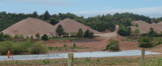
Photographs of Canada Geese at Aggregate Industries’ nearby Blackhill Quarry on the aptly named Seagull Pond can be found at the top and bottom of this post.
Canada geese are one of the more dangerous bird species for aircraft to strike because of their large size and because they travel in flocks of up to several hundred birds.
In 2017, in response to Aggregate Industries’ application to quarry Straitgate, Exeter Airport wrote:
Exeter Airport have no safeguarding objections to this development providing that the... conditions are adhered to at all times and there are no changes made to the current application. 
One of those conditions was: 
No new permanent bodies of water should be allowed on the site without prior consultation.
Permanent bodies of water like Aggregate Industries left after quarrying nearby Thorn Trees Plantation:


Permanent bodies of water like Aggregate Industries left after quarrying nearby Venn Ottery – as shown in the Council's latest monitoring report


Earlier this year, Exeter Airport wrote
Exeter Airport have no safeguarding objections to this development provided there are no changes made to the current application and that the previously submitted Wildlife Hazard Management plan is adhered to at all times.
On the proposed infiltration areas to contain flooding, the WHMP says: 
The primary purpose of ditches is to prevent flooding. These ditches reduce the amount of water ponding, therefore reducing the amount of food and habitat available to wildlife. They are critical in reducing the duration that critical areas are inundated for. This in turn reduces the amount of seasonal habitat for water birds and waders.
The problem is, there have been changes made to the current application, such that these drainage ditches or infiltration areas cannot work. Surface water runoff would not infiltrate evenly along the eastern boundary, given the revised gradient of the proposed extraction base, but would instead collect in the low areas. The ditches could not be accommodated where specified without breaching the maximum water table. Furthermore, the Environment Agency's drainage condition that "the working and restoration infiltration design shall ensure that drainage mimics the pre-excavation drainage" cannot be satisfied, given that the base of any quarry, the revised MWWT – the contours which would define, in perpetuity, a large part of the restored landform – do not mimic the existing topography. 

The Flood Risk Team has objected on the basis that "the applicant has not submitted sufficient information in order to demonstrate that all aspects of the surface water drainage management plan have been considered." 

Exeter Airport will be unaware of all of this. Exeter Airport will also be unaware that Aggregate Industries has, according to Professor Brassington, exaggerated the infiltration rates used in the design of these drainage ditches. The Flood Risk Assessment – which is now more than four years old and has not been informed by the elevated groundwater levels recorded, or the revised MWWT contours – has assumed unrealistic infiltration rates. Appendix C 2.2 says:
Infiltration rates of 1m/d (0.0416 m/hr) were applied to the infiltration ditches/ponds...
The soakaway tests carried out did not allow an infiltration rate to be determined using the BRE approach although the fall in water levels suggested a permeability in the order of 0.60 to 0.90 m/d. In my opinion, these results cannot be reliable because the loosely replaced broken-up material in the trial pit will not have been trafficked by heavy machinery in the same way that the proposed replaced layer would be. In any event, the tests were hardly conclusive as the comment was made ‘Insufficient drop in water level. Unable to calculate infiltration rate’. This does not suggest a permeability as high as 0.60 to 0.90 m/d, indeed, it could easily be in the range 0.06 – 0.09 m/d or even lower.
A lower infiltration rate will obviously affect the capacity that must be set aside to contain surface runoff. 

Exeter Airport has been consulted on unworkable, exaggerated, out-of-date information.

‘Extreme weather events arriving faster than climate models predicted’

The FT reports that the "deadly weather that has unfolded in recent weeks has left climate scientists “shocked” and concerned that extreme events are arriving even faster than models predicted."
Climate scientists say the severity of these events is simply “off scale” compared with what atmospheric models forecast — even when global warming is fully taken into account. 

“I think I would be speaking for many climate scientists to say that we are a bit shocked at what we are seeing,” said Chris Rapley, professor of climate science at University College London. “There is a dramatic change in the frequency with which extreme [weather] events occur.” 

Wednesday 21 July 2021

Aquifer pollution ‘seen on a routine quarry site visit’

More than 100 people rely on the aquifer at Straitgate Farm for their drinking water. Aggregate Industries' plans to quarry the site leave no margin for error, no margin for climate change, no margin for safety, no margin for pollution above the maximum water table – despite warnings from one of the UK's top experts in hydrogeology. What could possibly go wrong?

AI’s parent Holcim is a paid-up member of the API – a US lobby group ‘lying on an industrial scale to stall legislation to combat climate crisis’


The American Petroleum Institute has been in the news again:

When Royal Dutch Shell published its annual environmental report in April, it boasted that it was investing heavily in renewable energy... 
On the same day, Shell issued a separate report revealing that its single largest donation to political lobby groups last year was made to the American Petroleum Institute, one of the US’s most powerful trade organizations, which drives the oil industry’s relationship with Congress... 
Shell donated more than $10m to API last year alone. 

And it’s not just Shell. Most other oil conglomerates are also major funders, including ExxonMobil, Chevron and BP, although they have not made their contributions public. 

Critics accuse Shell and other major oil firms of using API as cover for the industry. While companies run publicity campaigns claiming to take the climate emergency seriously, the trade group works behind the scenes in Congress to stall or weaken environmental legislation. 

Earlier this year, an Exxon lobbyist in Washington was secretly recorded by Greenpeace describing API as the industry’s “whipping boy” to direct public and political criticism away from individual companies. 
Aggregate Industries' parent, Holcim – the rebranded Swiss cement giant that apparently "builds progress for people and the planet" whilst simultaneously filling our atmosphere with monstrous amounts of CO2 – is a paid-up member of the API:
Like Shell and the other oil majors, Holcim boasts of all it is doing to curb its harmful ways, putting "sustainability at the core of its strategy", claiming "Now is the time to act", etc etc:


But if that were true, why does Holcim still align itself with a lobby group accused of "lying on a massive industrial scale" about the climate crisis, that "works behind the scenes in Congress to stall or weaken environmental legislation"?

New version of the NPPF


The United Nations climate change goals have been added. As amended, Paragraph 7 now reads: 
The purpose of the planning system is to contribute to the achievement of sustainable development. At a very high level, the objective of sustainable development can be summarised as meeting the needs of the present without compromising the ability of future generations to meet their own needs. At a similarly high level, members of the United Nations – including the United Kingdom – have agreed to pursue the 17 Global Goals for Sustainable Development in the period to 2030. These address social progress, economic well-being and environmental protection. 
A government press release claims: 
Our revised National Planning Policy Framework will ensure that communities are more meaningfully engaged in how new development happens, that local authorities are given greater confidence in turning down schemes which do not meet locally set standards.

Sunday 18 July 2021

‘Climate is and will continue to be a WATER event’

There were shocking, apocalyptic scenes in Europe this week.


Hannah Cloke, Professor of Hydrology at the University of Reading, said
The deaths and destruction across Europe as a result of flooding is a tragedy that should have been avoided. 
The nature of the storm, the fact that it was extreme, that it had a lot of moisture in it, there was a lot of rainfall, it was slow moving - we have evidence that these types of storms are going to be more likely. 

This is one of those things that you expect to see under a changing climate.
Professor Bill McGuire, from UCL, was more blunt
The obvious acceleration of the breakdown of our stable climate simply confirms that - when it comes to the climate emergency - we are in deep, deep s***! 
Aggregate Industries is plainly a company that couldn't care. Its planning application for Straitgate Farm with its 2.5 million mile haulage plan effectively sticks two fingers up at the climate emergency – as does the company's greenwash document – despite all the apparent caring for the planet from parent Holcim, a company perpetually greenwashing its gargantuan CO2 emissions:


Climate change hasn't informed the company's application for Straitgate. No consideration has been given to the impact of the forecast wetter winters on the maximum water table, the base of any quarry; no consideration has been given to the fact that a quarry at Straitgate would PERMANENTLY change the landscape – on a hill above communities already prone to flooding. 


Familiar landscape turned into treacherous terrain: a gravel quarry south of Blessem, 40 hectares (99 acres) wide and 60 metres deep, rapidly filled with water, its edge expanding towards the town through headward erosion, swallowing up several cars, three half-timbered buildings and parts of a castle. 

When the owners of the Blessem gravel quarry applied for an expansion in 2015, local authorities granted their request on the condition they would build a 1.2km protective wall to prevent the pit from filling with water in the event of a flood. 

But the kind of extreme weather events the world is seeing with increasing frequency come with unpredictable consequences. The protective wall between the gravel pit and the Erft proved ineffective as the water overflowed higher up the river, gushing through the streets of the town before collecting at the lowest point.
We must pray the environmentalists below are wrong – No place is “safe” any more. We are entering nightmare times – but prepare as if they're not.
 

Flood design details should be left for a condition – suggests AI, again

Back in 2015, for its first planning application to quarry Straitgate, Aggregate Industries suggested
The proposed surface water management plan would use Sustainable Drainage Systems (SuDS), where all surface runoff originating within the workings will be captured in infiltration areas. These areas will have impermeable bunds at their downstream edges preventing any discharge to nearby watercourses. All runoff from the site will be captured in this way and allowed to infiltrate into the ground. A detailed drainage scheme would be developed and submitted for approval prior to the commencement of operations. 3.39
Devon County Council was having none of that, warning
The surface water management is inextricably connected to Flood Risk Management/Airport safeguarding and the need to maintain and recharge watercourses. This issue is so important in terms of the likely significant impacts of the proposal the MPA would wish to ensure that a SWM scheme can be designed to meet all of the requirements identified in advance of the determination of this application
That was when
The pattern and distribution of infiltration will be similar to that experienced under greenfield conditions…. It is intended that for each phase contouring of the eastern part of the excavation bases will be carried out to ensure that infiltration is distributed across the site in the same way as under greenfield conditions and to prevent too much water infiltrating from storm-water accumulation emerging at any one spring or part of the spring-line. 3.34
With regard to surface water management at the site entrance and ancillary areas: ... There will be no runoff allowed from the site entrance and ancillary areas onto Birdcage Lane 3.37
Both would no longer be the case – as we have posted here and here

But it’s not just that. Look what we find Aggregate Industries suggesting in its "final response": 
...the access road will drain to a swale, constructed alongside the road to hold back the additional runoff from the new access…. it will have a flow control mechanism fitted, the detailed design of which can be controlled by condition, to prevent uncontrolled discharge in to the [Birdcage Lane] roadside ditch. 
...can be controlled by a condition. After six years of trying to work out how to quarry the site without causing untold damage, six years to come up with detailed design, Aggregate Industries again wants to leave the detailed flood design for a condition. Lest we forget, and as repeated in May this year, DCC Flood Risk Management warned Aggregate Industries six years ago that details were needed, that the surface water strategy:
...should identify location of the infiltration features and how these fit into the site and the proposed phasing of the site. This should include detailed design regarding their size, details whether infiltration is permitted at the proposed locations and where targeted at areas where infiltration is required to support the spring lines of the existing watercourses (as commented by the Environment Agency), together with details of exceedance pathways.
...details, not concepts, not wishful thinking, not left for conditions away from the public gaze. 

A recent letter, from a lawyer representing a third party whose land is at risk, warned
Absent of revised calculations, there is no knowing whether "a flow control mechanism", as mentioned in the Letter, would have any chance of working. 

Policy M24 of the Devon Minerals Plan says (emphasis added): "All proposals for mineral development on a site exceeding one hectare, or any site within Flood Zones 2, 3a, 3b or a site in a Critical Drainage Area within Flood Zone 1, will be accompanied by a FRA that must demonstrate that the proposal will be safe for its lifetime taking account of the vulnerability of its users, without increasing flood risk elsewhere and, where possible, will reduce flood risk overall."

Given the FRA is now more than four years old and has not been informed by the revised base of extraction nor by the revised mitigation strategy, the Applicant has clearly not demonstrated that the proposal will be safe.
Too right it hasn’t. 

It hasn’t even answered how flooding prevention is meant to work here:

Thursday 15 July 2021

AI’s consultants ‘not coherent on hydrogeology’ – warns Professor, in new response

Professor Brassington – in reply to Wood’s follow-up notes after the meeting with the Environment Agency and others – has produced the following response in relation to Aggregate Industries’ proposal to quarry Straitgate Farm. His report begins: 
In my view the most significant aspect of the proposal by Aggregate Industries is the removal of the unsaturated zone over the area of the Straitgate Farm that is proposed to form the new quarry. In my opinion there is no doubt whatsoever that the water which percolates through this area will, once the unsaturated zone has been substantially removed have lost a significant exposure between the percolating water and the surrounding rock. Inevitably, this will mean that the rock/water interactions will have been reduced substantially which in turn can only result in the pH of the percolating waters being reduced and so the acidity of the spring waters will increase.
He also writes: 
I fail to see how Wood can come to their conclusion that the recharging water gets through the unsaturated zone in at the most a few days. All my experience of working on the Sherwood Sandstone aquifer has shown that where the rock is poorly cemented and therefore does not have any significant fractures, the rate of downwards flow is a metre or two a year. The references I have read confirm this view that I have discussed in a note dated 17th May 2021 and submitted to Devon CC. A summary of work carried out by numerous authors is given by Ascott et al (2016) that refers to an earlier paper by Chiltern and Foster (1991). The following table from Wang et al (2009) summarizes the general view of the British hydrogeological community on the downwards migration rates including those that apply to the Sherwood Sandstone.
And in summary: 
The arguments put forward by Wood do not present a coherent picture of the hydrogeology of the site. They appear not to understand the way that flow through the unsaturated zone works and that the moisture content of the rock defines its hydraulic conductivity. They draw conclusions from the data, such as on the hydraulic conductivity from the leach testing which are not valid as the tests do not provide data and they ignore Aggregate Industries data such as the grain-size analysis that shows that the fine particles in the rock will have a significant impact on reducing the hydraulic conductivity. 

Wood also misinterprets my statements about the impact of removing the unsaturated zone on the water quality to infer that I am against all quarrying while my arguments relate to this site only. They ignore the published data on flow velocities in the unsaturated zone and without carrying out any tests of their own conclude that the flow rates through the unsaturated zone at Straitgate are very much higher than is possible. They now appear to concede that piston flow takes place although they infer that fracture flow dominates water movement through the unsaturated zone. They interpret the relationship between rainfall events and rises in the water table as supporting their views on groundwater flow that ignore the simpler interpretation of it resulting from piston flow. 

In my view, Devon CC should not allow a proposal that will significantly reduce the pH of the drinking water supplies for about 100 local residents in the area around the proposed quarry site and I ask them to refuse the application.

Tuesday 13 July 2021

New spring found at Straitgate Farm – with big overburden consequences

This month – in the middle of summer – a new spring was discovered beyond the proposed extraction area, close to the fault indicated on the geological plan. What is the problem with that? The spring is exactly where Aggregate Industries wants to stockpile 82,000 cubic metres of overburden, as indicated on the phase 1 plan. Here is an overlay of those two plans:
 

It shouldn't be a surprise. The new spring is close to the borehole location SG21/90. The maximum water table contours – the MWWT, the contours that would dictate the base of any quarry at Straitgate Farm – have recently been revised to include the groundwater level recorded at SG21/90, where groundwater was recorded just 1.26m below the ground surface in June 1990

In addition, back in 2018, we informed the Environment Agency of a long-standing spring that feeds the Cadhay Wood Stream – marked X below – that had not previously been identified by consultants.
 

The EA responded: 
The presence of the spring emergence point up-gradient of Cadhay Wood Stream does not indicate that groundwater discharging into the stream originates from a wider area than previously understood.
The new spring – directly to the west of the X – feeds into the same watercourse. Where does this water go? Cadhay’s listed mediaeval fishponds. 

What are the overburden consequences? Before any overburden can be stored in that area, top soil and subsoils (including an as yet unspecified thickness of subsoil S2) must first be stripped – because soils must be stored like on like; overburden can only be stored on overburden
AREA OB1 DESIGNATED FOR THE TEMPORARY STORAGE OF OVERBURDEN. FOOTPRINT AREA = 23,400 SQ.M TO BE STRIPPED OF TOPSOIL (0.3M) AND SUBSOIL (0.25M) IN ADVANCE, WITH MATERIALS SEPARATELY STOCKPILED INTO APPROPRIATE NEAREST DESIGNATED STORAGE AREA. POTENTIAL OVERBURDEN STORAGE CAPACITY OF 82,000 CU.M ... 
And the problem with that? In an effort to protect groundwater, the EA has conditioned that no working shall be undertaken below the maximum water table. Plainly, if water is issuing from the ground in July, then groundwater is too close to the surface for digging to be permitted in this area. 

So, where could overburden be stored? Where could the removal of top soils plus subsoils not breach the maximum water table? No one knows. No groundwater monitoring has been carried out in the proposed overburden storage areas. 

Aggregate Industries’ soil storage plans have already run into problems with Natural England. This is another mess.
 

A local resident’s letter to DCC – no doubt reflecting what many of us are thinking

A pointless Second Consultation 

Further to my letter objecting to the re-hashed planning application, I am writing in response to the publication of AI's letter of clarification, their self-styled "final response". On the basis that it contains new information, DCC have decided that a follow up public consultation is now required. I am sure that I am not alone when I say that this is baffling. 

In responding to the application in May, stakeholders have, once again, taken a great deal of time and trouble to make sense of this shambles of a document. As a result of their efforts, it is obvious that there are still no resolutions to the many problems and issues which have dogged it from the beginning. Whether it is the novel concept of MWWT, the soil management, the flood defence plans, aquifer destruction, loss of drinking water, destruction of natural habitat, the cattle crossing problem, the eco-hostile haulage scheme, the list goes on and on. Each and every one is a deal breaker in its own right if not resolved. To cap it all, it must be clear by now that there are well less than 1m tonnes of aggregates available at Straitgate if quarrying were to go ahead - the biggest deal breaker of them all. 

But what do we get from Aggregate Industries in response to all these pressing unresolved issues? A cursory four page letter from a non-specialist representative saying, to all intents and purposes, that as far as they are concerned there is nothing to add, and that the matter is now closed. Interpreted more colloquially this is "two-fingers to the lot of you!" Plainly AI want a quarry approved at Straitgate, come what may, and they have finally lost patience with the general public. 

What is baffling, however, is why DCC are going along with the charade of a second consultation on the basis of AI’s letter. It contains nothing of substance worth responding to, and another consultation is therefore no more than a token gesture. The only possible conclusion? Stakeholders are being led by the nose through one more step in a series of meaningless formalities with the aim of engineering AI's long desired approval of this application. It doesn't look good. 

The danger is that the Straitgate application process is fast losing credibility. There seems to be an overarching agenda guiding its progress, of which the public have not been made aware. They sense it. What is the point of any one taking the trouble to pen a considered response if, time and again, their many reasonable and clearly expressed concerns are simply trampled on and ignored. Proper answers are required to issues which could have a significant impact on their lives, but all they get is a “final response” from on high. The brush off. 

If a modicum of faith is to be restored, then I would suggest that a good start would be to inform AI that their “final response” is not acceptable, and falls well below the standards required to qualify their application for final determination and approval. Colloquially speaking, “they’re having a laugh”. If DCC, on the other hand, cannot find it in themselves to tell them this, or do not even recognise that they need to, then the system is well and truly broken.

Thursday 8 July 2021

Devon school children take action to reduce carbon emissions

Last month, Devon County Council announced
School communities across Devon completed over 23,000 active journeys during this year’s Sustrans Big Pedal, the UK’s largest walking, wheeling, cycling and scooting to school challenge. During the competition, which took place between 19 to 30 April, Devon school children were physically active – walking, cycling, wheeling and scooting to school, and completing physical activities – for a total of nearly 240,000 minutes... 
If the children taking active journeys during Sustrans Big Pedal had travelled to school by car instead, this could have created 14 tonnes of CO2 and 27kg of NOx. That’s enough to fill over 510,000 party balloons with harmful CO2 emissions.

It's a fantastic achievement.

How unfortunate that corporate polluters aren't making the same efforts. Aggregate Industries' plans for Straitgate Farm, for example, would fill over 160,000,000 party balloons with harmful CO2 emissions.

Holcim unveils new identity

The parent company of Aggregate Industries has announced a new identity:


Jan Jenisch, Chief Executive Officer at Holcim proclaimed: 
Today marks a milestone for our company in our transformation to become the global leader in innovative and sustainable solutions. Our world is changing in many ways, with population growth, urbanization and the climate challenge. We are determined to play our part to accelerate low-carbon and circular construction so that we build a net zero future and raise living standards for everyone. Our new Group identity sends a signal to the world that we are fully committed to building progress for people and the planet. 
But whatever signal Holcim sends to the world, whatever clever graphics the branding consultants conjure up, a leopard can't change its spots, the world’s largest cement company can’t make cement without gargantuan CO2 emissions.

Wednesday 7 July 2021

DCC starts another consultation

Devon County Council has now started another public consultation on Aggregate Industries’ planning application to quarry Straitgate Farm, this time on the company’s "final response" submitted last week. This follows the consultation in April on the company’s "final submission of additional information".

This latest consultation runs until 31 July for those wishing to make "any additional comment" – particularly on the "final response", supplied in relation to hydrogeology, flooding and soils. This means the application will not now be determined before the next DMC meeting of 22 September 2021

Devon County Council has termed this latest response as providing clarification. In reality, it clarifies nothing, except to demonstrate that Aggregate Industries still hasn’t got a clue what it’s doing. 

We have recently posted about its contents, here, here and here. The response to concerns raised by the Devon Flood Risk Team and Natural England, on flooding and soils, is frankly laughable; a derisory, dismissive letter written by the company’s planning manager, not the relevant experts – which clearly fails to address the concerns that have been raised by these statutory consultees. 

Specifically, Aggregate Industries refused to show how infiltration basins could be accommodated within the extraction site – taking into account the elevated groundwater levels recorded. Aggregate Industries refused to show how the separate subsoils could be stored, and further chose to forget all about the topsoils and subsoils under the storage piles, for which space must also be found. 

The hydrogeology response to Professor Brassington following this meeting was little better, failing to provide any references – other than to its own – to back up its assertions that groundwater speeds through the unsaturated zone in a matter of days having little time for rock/water interactions. Prof Brassington – who has provided multiple independent references to substantiate his claims – says movement of water through the unsaturated zone is likely to take years, and permanently removing the unsaturated zone would have an irreversible impact on the pH of surrounding water supplies: 
According to Wang et al (2012) the unsaturated zone velocity for the Sherwood Sandstone Group falls in the range 0.6 – 2.3 m/year with a mean of 1.06 m/year (these values were summarized by Chilton and Foster (1991)). The values for unsaturated zone flow rates are several orders of magnitude (three to five) lower than flow velocities in the saturated zone.
What evidence do Aggregate Industries' consultants have? Apparently, Straitgate is riddled with fractures and fissures. The problem? Test pits didn’t reveal any. Nor do the cliffs showing the same geology at Budleigh Salterton. Consultants have therefore resorted to the old adage "absence of evidence is not equal to evidence of absence". It’s a phrase that’s often wheeled out "to silence doubters and critics": 
The "absence of evidence..." argument in itself is fine; in the hands of promoters of nonsense, however, it all too often turns into a prime example of apparently plausible yet fundamentally flawed logic which can mislead us all. 
There’s no evidence that little green men are absent from Straitgate either, but that does not mean we should seriously consider their existence. As Prof Brassington says
The lack of cement means that the rock cannot be fractured as the adjacent uncemented particles would fall into any fractures present. 
Here’s one of the test pits that Aggregate Industries’ consultants claim is only 2-3m deep. It was in fact used to recover BSPB material for testing, so had to be 6-7m deep. Can anybody see any fractures? No, neither could Prof Brassington
In Amec Foster Wheeler (2017b) a series of photographs are published of the trial pits... I have examined them most carefully and find no evidence for any fractures or fissures.
What else? Where do we start? Many of Aggregate Industries' documents are now obviously out of date. The Transport Assessment will be more than 3 years old, and is riddled with errors. The Flood Risk Assessment is more than 4 years old, and has not been informed by the elevated groundwater levels recorded. The wildlife surveys are older than that. The cattle crossing issue has not been resolved; EDDC has now lodged an objection based on that issue. Highways England is still awaiting clarification and assurances. Devon Garden Trust, a statutory consultee, has objected. It is unknown how alternative water supplies would be provided – including to the listed mediaeval fishponds at Cadhay – in the event of problems. There’s no recoverable resource in parts of the site, and insufficient groundwater movement to allow the company’s untested seasonal working scheme to work. The list goes on. Have you ever seen such a mess? 

And yet there are fundamental issues that would need to be resolved, not least on the model of the water table, on flooding, infiltration areas, on inadequate culvertspost restoration drainage patterns, drinking water supplies, on the safe functioning of the B3174, the unsustainable haulage emissions, the restoration of best and most versatile agricultural land, the working drawings that don’t work, even the schoolchildren waiting for buses and the unenforceable, unworkable HGV embargo. 
 
Comments on this final final submission, or any other part of the application, should be made to Devon County Council, either online or by email to planning@devon.gov.uk including name, address and the reference number DCC/3944/2017.

Tuesday 6 July 2021

If the B3174 were in Lincolnshire – it would be too narrow for quarry HGVs

A decision by Lincolnshire County Council for planning application PL/0082/20 – for land at King Street, Greatford, to work 3 million tonnes of sand and gravel over 16 years with 70-80 HGV movements per day – was deferred this week following representations stating the access road would be too narrow
...the proposed 20cm increase in the road width, which would make it 5.5m wide in places, would not be sufficient... she had read government guidelines that said 6.8m was recommended "where HGVs were likely to pass each other on a regular basis". 
...HGVs often measured 3m in width with their mirrors, meaning 5.5m would be too narrow.
Meanwhile, in Devon, Aggregate Industries' proposal at Straitgate Farm is for up to "216 HGV trips per day" on the B3174 – a 53% increase in the number of trucks. How wide is this road? The company's Transport Assessment says the B3174 "Varies 5.3 to 8.8 m". 

The narrow width is no doubt part of the reason why there are so many accidents – including HGVs.

The Supporting Statement for Aggregate Industries' "inextricably linked" Hillhead application said: 
It is proposed to widen Clay Lane... to achieve an overall carriageway width of 7.3 metres. This will allow the safe two-way lorry movements for all mineral and waste related traffic.
The implication, of course, being that anything less than 7.3m is not safe. Even the access road into the Straitgate site "will comprise a 6.0 m wide road". So why should the B3174 – a busy 60mph road which is only 5.3m wide in places – be acceptable for the export of Straitgate material? 

If the B3174 were in Lincolnshire, it wouldn’t be. The Transport Statement said: 
1.3 ...[Lincolnshire] County Council asked for a review of the width of King Street and its suitability to accommodate additional HGV movements. In their email of 22nd November 2019 the LHA requested a minimum width of the main access route to be 5.5m... 
The Officer’s Report proposed the condition: 
that localised carriageway widening, to a total width of not less than 5.5 metres, should be provided on an identified section of King Street where the carriageway is presently less than 5.5 metres wide. 
Objectors claimed this widening was insufficient. They have a point. 

Where vehicle speeds are greater than 37 mph, national guidance recommends new roads should be 7.3m wide; only where speeds are below 37mph is 5.5m acceptable for two-way HGV movements. 

However, that's not the end of the story. HS2 came along. Staffordshire County Council wrote
A width of 5.5m... is barely sufficient to accommodate two cars and is against HS2’s own policy of a 6.8m width for realigned roads where HGVs regularly pass
HS2's own policy? The HS2 Rural Road Design Criteria says: 
A.1.1 In many cases, published design standards are not fully relevant to rural roads (especially minor ones)... 
A.1.5 A set of design criteria have therefore been developed for works on rural roads where no other design basis is suitable, and it is intended to provide a safe, consistent and proportionate approach to help ensure that the character and distinctiveness of such routes is retained as far as is reasonable [sic] practicable. 
What does it say about carriageway width for two-lane roads?
A.6.3 Rural road widths for diversions should generally match the existing, subject to a minimum of 5.5 metres (the minimum for two cars to pass in safety at low speed). This minimum width shall be increased to 6.0 metres for lengths with occasional use by buses or heavy goods vehicles and 6.8 metres for roads where buses or heavy goods vehicles are likely to pass each other on a regular basis
So, if 5.5m is the minimum for two cars to pass in safety at low speed, why has Devon County Council not raised any objection over up to "216 HGV trips per day" on a busy 60mph road as little as 5.3m wide?

Monday 5 July 2021

AI fails to answer Natural England’s BMV & subsoil concerns – and gets soil storage numbers completely wrong

We recently posted that Aggregate Industries – in its "final response" – had refused to supply cross sections to Devon County Council's Flood Risk Management Team in its role as Lead Local Flood Authority, to show how the infiltration areas intended to prevent downstream flooding could be accommodated within the extraction area. 

In the same final response, Aggregate Industries has also failed to answer Natural England's concerns on how the soils would be restored back to best and most versatile agricultural land, particularly how the two subsoil resources would be stored and restored. Soil volume numbers are also completely wrong.

The Soils Report provided by Aggregate Industries states: 
Two subsoil resources have been identified, one heavy loam and one clay. 

Subsoil S1 

4.4 Although there is some variation in texture across the site, the upper layer of subsoil is medium to heavy textured and can be considered as a single resource. It is easily damaged by mishandling and should be stripped when as dry as possible down to the easily distinguished clay or the gravel layers which are below it. The thickness of the this [sic] resource is variable, and in some localities extends below 1.2 m depth, but the mean thickness is approximately 250 mm...  

Subsoil S2 

4.5 This comprises the dense clayey or heavy clay loam lower subsoil which is a poorer resource easily damaged by mishandling. Its thickness cannot be estimated from an auger survey. 
The Soils Management Scheme document, again provided by Aggregate Industries, states:
...although the topsoil was a single unit across the application site, the subsoil was split into two types, broadly relating to the different ALC gradings: subsoil type 1 coincided with Grade 2; subsoil type 2 coincided with Grade 3b; whilst Grade 3a had both subsoil types.

All topsoil and the two subsoil (upper and lower) units will be stripped and stored separately to enable later reuse as part of final restoration. 
In its final response, Aggregate Industries says the following soil quantities would be generated: 
Grade 2 (3ha) – 9,000m3 of top soil [300mm] and 7,500m3 of sub soil [250mm] 
Grade 3a (14ha) – 42,000m3 of topsoil [300mm] and 35,000m3 of subsoil [250mm] 
Grade 3b (2ha) – 6,000m3 of topsoil [300mm] and 5,000m3 of subsoil [250mm] 
We have added the implied depth of material in brackets. 

But the numbers are nonsense. They IGNORE the topsoils that must be removed from subsoil storage areas, and they IGNORE the topsoil and subsoils that must be removed in overburden storage areas – because like must be stored on like. The Soils Management document says:  
3.3 Topsoil would be stripped in advance of subsoil mound construction and the topsoil and subsoil would be stripped in advance of overburden mound construction... 3.2 (to allow like-on-like materials to be placed on top of each other). 
How much additional soil would be generated from the storage areas? The drawing below gives a clue.

Furthermore, where are the details about subsoil S2 in Aggregate Industries' response? Subsoil S2 is found across the bulk of the site. The company's Soil Report says: 
4.9 To restore the land to agricultural best and most versatile quality will require a profile of at least 550 mm of topsoil and loamy subsoil placed over subsoil S2
The Soils Management Scheme report warns:
3.1 The main limitation to restoring the entire application site to best and most versatile quality will be the inherent characteristics of subsoil type 2
The degree to which the best and most versatile land should be capable of being reclaimed without loss of quality. 

Without this information, Natural England may need to object to the proposal. 

Please re-consult Natural England once this information has been obtained.
 

Amongst other things, the statutory consultee wanted to know about the two subsoil resources: 
Natural England note that two subsoil resources have been identified on the site... 

The Soil Management Scheme does not make it clear that the subsoils S1 and S2 will be stripped and stored separately and the plans submitted... detailing the onsite designated areas for the temporary storage of subsoil do not show the storage location of subsoils S1 and S2... Without the separate stripping and storage of the subsoil S1 and S2, the accurate detailing of their storage location, and the restoration as described in the ES Ch 14 above it is our advice that this would [compromise] the ability to achieve high standards of restoration and to restore the land to agricultural best and most versatile quality
So – given Natural England requested information on subsoils S1 and S2 – where is that information? If both are needed to restore the land back to BMV, why is there no mention of the two subsoil resources in the company's final response? Why is there no mention of how these two resources would be stored?

But Aggregate Industries doesn’t just fail there. The company claims: 
In respect of the maximum extent of disturbed land open for which storage capacity is required, this has been calculated as follows: 
Ancillary area – 8ha (top and sub soil stripped only) 
Phase 1 – 6ha (top soil, sub soil and overburden stripped) 
50% of Phase 2 – 5ha (top soil, sub soil and overburden stripped)
But it is plain to anyone who reads the Soils Management document – "3.2 All of the soil resources from Phase 3 will then be direct placed into the previously worked out void, as shown in Drawing SF / 5-3 Rev B" – and who looks at that drawing "SF / 5-3 REV B", that the above is not correct. The drawing shows all the phases in operation; phase 1 would not start to be restored until the beginning of phase 3: 
SOILS FROM PHASE 3 DIRECT PLACED ONTO PHASE 1 
In conclusion, "the maximum extent of disturbed land open for which storage capacity is required" would significantly exceed the area claimed in Aggregate Industries' final response. Additional capacity would be needed to accommodate all the different soil types from the extraction, ancillary and storage areas. Where would all that capacity be found?

Six years on from first submitting this planning application, Aggregate Industries still can't seem to get its head around soil management. 
 

Aggregate Industries ‘do not dispute there is plenty of sand and gravel in Devon’

The document "Guidance on the planning for mineral extraction in plan making and the application process" is published by the Government. Paragraph: 010 Reference ID: 27-010-20140306 says
The suitability of each proposed site, whether an extension to an existing site or a new site, must be considered on its individual merits, taking into account issues such as: 

* need for the specific mineral...
Bearing this in mind, it is interesting to note that barely six months ago the very same planning manager behind Aggregate Industries’ application to quarry Straitgate Farm admitted to Dorset Council that: 
We do not dispute that there is plenty of sand and gravel in Devon
In which case, what on earth is the point in trying to wrestle a relatively small and ever-decreasing amount of sand and gravel from the quite obviously constrained site at Straitgate Farm, risking a catalogue of harm to the surrounding community, pumping goodness knows how much pollution and CO2 into the atmosphere, with each truckload of as-dug material necessitating a round trip of 46 miles to the processing plant?