Showing posts with label soils. Show all posts

Monday, 6 September 2021

Why is soil conservation important?

It takes 200 – 400 years to create 1 cm of new soil; it takes around 3,000 years to make a soil fertile

Soil is therefore considered a non-renewable resource: once it has been destroyed, it is lost forever

humanity must now produce more food in the next four decades than we have in the last 8,000 years of agriculture combined
Countries can withstand coups d’état, wars and conflict, even leaving the EU, but no country can withstand the loss of its soil and fertility. 
In 2014 Sheffield University researchers said that UK farm soils only had 100 harvests left in them, and a year later a UN spokesperson warned that at current rates of degradation, the world’s topsoil could be gone within 60 years.
 A recent study warns that soil erosion will increase because of climate change:


Aggregate Industries' proposal to quarry Straitgate Farm has prompted renewed concerns from Natural England about the storage of soils – topsoil, subsoils and overburden – soils that currently form best and most versatile agricultural land. These concerns have not been addressed. The Devon Minerals Plan states "a proposal affecting the best and most versatile land should provide for the restoration of the land to its former quality." Click on the soils label for more detail.

Friday, 6 August 2021

More overburden storage problems

According to Aggregate Industries, 159,000 cubic metres of overburden material from above the sand and gravel resource would need to be stored elsewhere on site in 5m high mounds if Straitgate Farm were to be quarried, material that would in time need to be restored. 

The issue of soil storage is important. The Devon Minerals Plan states "a proposal affecting the best and most versatile land should provide for the restoration of the land to its former quality." Natural England had asked for more information on the storage of subsoils, information that was not supplied

The different categories of retained soils must be stored like-on-like. Overburden can only be stored on overburden. Topsoils and subsoils S1 and S2 would first need to be removed from those storage areas, and stored elsewhere. At the same time, in line with proposed conditions from the Environment Agency, "no working shall be undertaken below the ‘Maximum Winter Water Table (MWWT) grid’" or "closer to the contemporaneous measured groundwater level than 1m." 

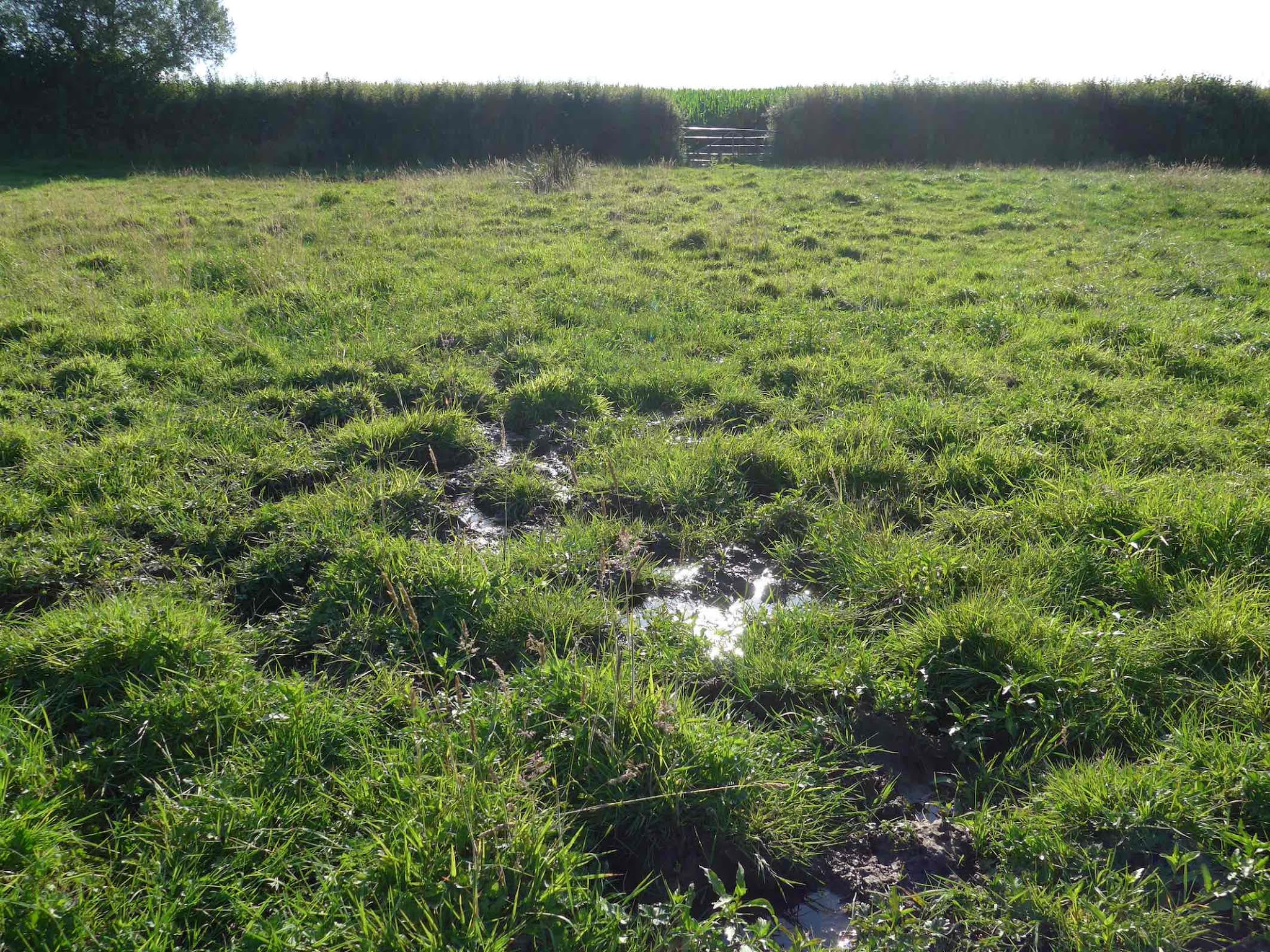
We have recently posted that – in the middle of summer – a new spring was discovered exactly where Aggregate Industries wants to stockpile 82,000 cubic metres of overburden in the area designated OB1. The new spring is close to the borehole location SG21/90 where groundwater was recorded just 1.26m below the ground surface in June 1990. 


However, there’s clearly a further problem. The geological plan shows groundwater close to the surface in the other area designated for overburden storage, OB2, where Aggregate Industries wants to stockpile another 77,000 cubic metres of overburden. Borehole SG12/90 recorded groundwater at 1.59m below the surface – again in the middle of summer, in June 1990. 

The EA has stipulated that these 1990 groundwater levels should inform the application

There is clearly an unmistakable pattern beyond the eastern boundary of the extraction area, along the geological fault line, exactly where Aggregate Industries wants to store overburden. 


This is a photograph of another spring, issuing to the north of the planning red line boundary as indicated at the top of the above plan, taken just last week. 


So, where could overburden be stored where the removal of topsoils plus subsoils would not breach the maximum water table, where groundwater would be at least 1m below any working? Given that no groundwater monitoring has been carried out in the proposed overburden storage areas, no one knows.

Tuesday, 13 July 2021

New spring found at Straitgate Farm – with big overburden consequences

This month – in the middle of summer – a new spring was discovered beyond the proposed extraction area, close to the fault indicated on the geological plan. What is the problem with that? The spring is exactly where Aggregate Industries wants to stockpile 82,000 cubic metres of overburden, as indicated on the phase 1 plan. Here is an overlay of those two plans:
 

It shouldn't be a surprise. The new spring is close to the borehole location SG21/90. The maximum water table contours – the MWWT, the contours that would dictate the base of any quarry at Straitgate Farm – have recently been revised to include the groundwater level recorded at SG21/90, where groundwater was recorded just 1.26m below the ground surface in June 1990

In addition, back in 2018, we informed the Environment Agency of a long-standing spring that feeds the Cadhay Wood Stream – marked X below – that had not previously been identified by consultants.
 

The EA responded: 
The presence of the spring emergence point up-gradient of Cadhay Wood Stream does not indicate that groundwater discharging into the stream originates from a wider area than previously understood.
The new spring – directly to the west of the X – feeds into the same watercourse. Where does this water go? Cadhay’s listed mediaeval fishponds. 

What are the overburden consequences? Before any overburden can be stored in that area, top soil and subsoils (including an as yet unspecified thickness of subsoil S2) must first be stripped – because soils must be stored like on like; overburden can only be stored on overburden
AREA OB1 DESIGNATED FOR THE TEMPORARY STORAGE OF OVERBURDEN. FOOTPRINT AREA = 23,400 SQ.M TO BE STRIPPED OF TOPSOIL (0.3M) AND SUBSOIL (0.25M) IN ADVANCE, WITH MATERIALS SEPARATELY STOCKPILED INTO APPROPRIATE NEAREST DESIGNATED STORAGE AREA. POTENTIAL OVERBURDEN STORAGE CAPACITY OF 82,000 CU.M ... 
And the problem with that? In an effort to protect groundwater, the EA has conditioned that no working shall be undertaken below the maximum water table. Plainly, if water is issuing from the ground in July, then groundwater is too close to the surface for digging to be permitted in this area. 

So, where could overburden be stored? Where could the removal of top soils plus subsoils not breach the maximum water table? No one knows. No groundwater monitoring has been carried out in the proposed overburden storage areas. 

Aggregate Industries’ soil storage plans have already run into problems with Natural England. This is another mess.
 

Monday, 5 July 2021

AI fails to answer Natural England’s BMV & subsoil concerns – and gets soil storage numbers completely wrong

We recently posted that Aggregate Industries – in its "final response" – had refused to supply cross sections to Devon County Council's Flood Risk Management Team in its role as Lead Local Flood Authority, to show how the infiltration areas intended to prevent downstream flooding could be accommodated within the extraction area. 

In the same final response, Aggregate Industries has also failed to answer Natural England's concerns on how the soils would be restored back to best and most versatile agricultural land, particularly how the two subsoil resources would be stored and restored. Soil volume numbers are also completely wrong.

The Soils Report provided by Aggregate Industries states: 
Two subsoil resources have been identified, one heavy loam and one clay. 

Subsoil S1 

4.4 Although there is some variation in texture across the site, the upper layer of subsoil is medium to heavy textured and can be considered as a single resource. It is easily damaged by mishandling and should be stripped when as dry as possible down to the easily distinguished clay or the gravel layers which are below it. The thickness of the this [sic] resource is variable, and in some localities extends below 1.2 m depth, but the mean thickness is approximately 250 mm...  

Subsoil S2 

4.5 This comprises the dense clayey or heavy clay loam lower subsoil which is a poorer resource easily damaged by mishandling. Its thickness cannot be estimated from an auger survey. 
The Soils Management Scheme document, again provided by Aggregate Industries, states:
...although the topsoil was a single unit across the application site, the subsoil was split into two types, broadly relating to the different ALC gradings: subsoil type 1 coincided with Grade 2; subsoil type 2 coincided with Grade 3b; whilst Grade 3a had both subsoil types.

All topsoil and the two subsoil (upper and lower) units will be stripped and stored separately to enable later reuse as part of final restoration. 
In its final response, Aggregate Industries says the following soil quantities would be generated: 
Grade 2 (3ha) – 9,000m3 of top soil [300mm] and 7,500m3 of sub soil [250mm] 
Grade 3a (14ha) – 42,000m3 of topsoil [300mm] and 35,000m3 of subsoil [250mm] 
Grade 3b (2ha) – 6,000m3 of topsoil [300mm] and 5,000m3 of subsoil [250mm] 
We have added the implied depth of material in brackets. 

But the numbers are nonsense. They IGNORE the topsoils that must be removed from subsoil storage areas, and they IGNORE the topsoil and subsoils that must be removed in overburden storage areas – because like must be stored on like. The Soils Management document says:  
3.3 Topsoil would be stripped in advance of subsoil mound construction and the topsoil and subsoil would be stripped in advance of overburden mound construction... 3.2 (to allow like-on-like materials to be placed on top of each other). 
How much additional soil would be generated from the storage areas? The drawing below gives a clue.

Furthermore, where are the details about subsoil S2 in Aggregate Industries' response? Subsoil S2 is found across the bulk of the site. The company's Soil Report says: 
4.9 To restore the land to agricultural best and most versatile quality will require a profile of at least 550 mm of topsoil and loamy subsoil placed over subsoil S2
The Soils Management Scheme report warns:
3.1 The main limitation to restoring the entire application site to best and most versatile quality will be the inherent characteristics of subsoil type 2
The degree to which the best and most versatile land should be capable of being reclaimed without loss of quality. 

Without this information, Natural England may need to object to the proposal. 

Please re-consult Natural England once this information has been obtained.
 

Amongst other things, the statutory consultee wanted to know about the two subsoil resources: 
Natural England note that two subsoil resources have been identified on the site... 

The Soil Management Scheme does not make it clear that the subsoils S1 and S2 will be stripped and stored separately and the plans submitted... detailing the onsite designated areas for the temporary storage of subsoil do not show the storage location of subsoils S1 and S2... Without the separate stripping and storage of the subsoil S1 and S2, the accurate detailing of their storage location, and the restoration as described in the ES Ch 14 above it is our advice that this would [compromise] the ability to achieve high standards of restoration and to restore the land to agricultural best and most versatile quality
So – given Natural England requested information on subsoils S1 and S2 – where is that information? If both are needed to restore the land back to BMV, why is there no mention of the two subsoil resources in the company's final response? Why is there no mention of how these two resources would be stored?

But Aggregate Industries doesn’t just fail there. The company claims: 
In respect of the maximum extent of disturbed land open for which storage capacity is required, this has been calculated as follows: 
Ancillary area – 8ha (top and sub soil stripped only) 
Phase 1 – 6ha (top soil, sub soil and overburden stripped) 
50% of Phase 2 – 5ha (top soil, sub soil and overburden stripped)
But it is plain to anyone who reads the Soils Management document – "3.2 All of the soil resources from Phase 3 will then be direct placed into the previously worked out void, as shown in Drawing SF / 5-3 Rev B" – and who looks at that drawing "SF / 5-3 REV B", that the above is not correct. The drawing shows all the phases in operation; phase 1 would not start to be restored until the beginning of phase 3: 
SOILS FROM PHASE 3 DIRECT PLACED ONTO PHASE 1 
In conclusion, "the maximum extent of disturbed land open for which storage capacity is required" would significantly exceed the area claimed in Aggregate Industries' final response. Additional capacity would be needed to accommodate all the different soil types from the extraction, ancillary and storage areas. Where would all that capacity be found?

Six years on from first submitting this planning application, Aggregate Industries still can't seem to get its head around soil management. 
 

Thursday, 20 May 2021

Without further information, ‘Natural England may need to object to the proposal’

Since submitting its first planning application to quarry Straitgate Farm back in 2015, Aggregate Industries has been granted 6 years by Devon County Council to resolve the various problems that have arisen.
 
And yet, there are still a multitude of substantive issues the company must resolve. Would it ever be able to resolve them? Are the complexities of Straitgate Farm simply beyond the capabilities of Aggregate Industries and its paid-up army of consultants? 

What hope is there to resolve the complicated issues, when it can’t even get the basics right? Take soils. 

Straitgate Farm comprises best and most versatile agricultural land. The Devon Minerals Plan says: 
The site should be restored to enable resumption of agricultural use. To ensure the site is restored to an appropriate grade of agricultural land quality, proposals should assess the Agricultural Land Classification and detail proposed soil management techniques should be used throughout the site working and restoration stages. The working and restoration phasing should minimise the area of land not in cultivation, as soil is best conserved by being farmed rather than stored where some deterioration may occur. 
Restoration back to BMV would obviously be a tall order, given that topsoils would be stored 3m deep for up to 12 years. The company's supporting statement claims "The long term after-use would be light intensity agricultural grazing." Land that could only support "light intensity agricultural grazing" is by definition not BMV. Soils suffer significant deterioration when stockpiled in piles more than 1m deep for long periods of time. They suffer rapid loss in organic carbon levels and soil organisms. Earthworms are key for soil quality but do not survive at depths greater than 1m. Soils stored in bunds become anaerobic within a few weeks. Soils stored for longer than a year suffer irreversible impacts. 

Natural England has now responded again to the application. It is the fifth time this statutory agency – the one charged with protecting our natural environment and the one now "cut to the bone" – has had to deal with the proposal – excluding the multitude of responses in relation to the site's inclusion in the Minerals Plan, and Aggregate Industries' in-tandem applications to import material to Blackhill and Hillhead. Previous Natural England responses for Straitgate can be found here, here, here and here

Natural England first warned Aggregate Industries about soils back in 2015: 
as the site is BMV, the same area of BMV land should be restored. If there is no topsoil in an area it cannot be returned to grade 3a. 
Details are needed on the restored profile. Para 3.42 refers to a restored profile of 1m, whereas the usual target profile would be 1.2m. The MAFF ALC survey shows that there are two distinct subsoils, which should be stripped and stored separately ready for replacement, however there is only reference to a single subsoil in the supporting documents.
Given the nature and extent of the comments and requirements from Natural England regarding soil storage it would be helpful if you could update the soils management strategy to include the comments made by NE. Additionally, I would wish AI to comment on the relationship between the NE requested condition that soils should not be stripped in the winter months, the ongoing farm management and soils storage methodology. 
A soils management report was duly produced – the one recently consulted on – claiming "no loss of best and most versatile land." It was a big claim, and a questionable one, particularly given all the material needed to buttress the A30

But nothing was written about soil movements during the winter, or – remembering the Mineral Plan's advice that "soil is best conserved by being farmed rather than stored" – how soil storage would work with ongoing farm management. Nothing was written about separately storing the "two distinct subsoils" that Natural England had referenced in 2015. 

So here we are, in 2021, with Aggregate Industries still not having worked out something as basic as how and where it will store all the soils. Is the company just incompetent? Natural England now says
As submitted, the application could have potential significant effects on soils. Natural England requires further information in order to determine the significance of these impacts and the scope for mitigation. The following information is required: • The degree to which the best and most versatile land should be capable of being reclaimed without loss of quality. Without this information, Natural England may need to object to the proposal. 
The Soil Management Scheme and the detailed area plans submitted do not clearly identify the origin, intermediate and final locations of soils for use in the restoration, as defined by soil units (topsoil T1 and subsoils S1 and S2), together with details balancing the quantities (demonstrating the site has storage capacity), depths, and areas involved. We would expect restored soil profile to resemble pre working soil profile … if the grade is to be maintained. 
...the Soils and Agricultural Land Classification Report (ES Ch 14) states that there is Grade 2, 3a and 3b soils present on site…. reports should detail how it is intended to restore an equivalent area of Grade 2 and 3a of the soils on site being disturbed by these proposed works, specifically with soil volumes and restoration profiles provided. 
Without the separate stripping and storage of the subsoil S1 and S2, the accurate detailing of their storage location, and the restoration as described in the ES Ch 14 above it is our advice that this would [compromise] the ability to achieve high standards of restoration and to restore the land to agricultural best and most versatile quality. 
Aggregate Industries has had so much time – more than enough time, most reasonable people would think – to sort these things out. What is the point of statutory consultees providing response after response if Aggregate Industries just ignores them?

Monday, 3 May 2021

Is there a shortfall of material to restore Straitgate to BMV land and prop up the A30?

In the application to quarry Straitgate Farm, Aggregate Industries’ Supporting Statement claims:
3.3.5 The total overburden volume is estimated at 510,000m3.
4.9.3 All topsoil and the two subsoil (upper and lower) units will be stripped and stored separately to enable later reuse as part of final restoration. Backfilling of the floor with a minimum of 1.65m of overburden with 300mm of topsoil, over 250mm of loamy subsoil which will provide 2.2m in total.
However, the statement also claims:
3.8.2 The restoration landform allows for accommodation of the 720,000m3 of restoration materials by means of the creation of gently graded slopes down to the restored base of the quarry. The base of the extraction area will be restored by placement of at least 2 metres combined thickness of topsoil, subsoil and overburden over the quarry floor to replicate current ground conditions. For areas of the site that are to be developed as species rich grassland, then topsoil will not be used in the restoration soil profile and the subsoil would be placed more thinly on the overburden to create the less fertile growing conditions required for establishing this type of plant community. 
The new resource statement, subject of the recent consultation, puts the overburden at 600,000m3. 

But given that the "restoration landform allows for accommodation of the 720,000m3 of restoration materials" is there a shortfall of material to restore Straitgate, a shortfall of 120,000m3, some 228,000 tonnes, some 8000 truck loads? 

It’s worth asking. Not only because Aggregate Industries is miraculously claiming "no loss of best and most versatile land" – which means handling, storing, restoring exactly the same profile of soils and subsoils that were removed – but also because a large but unquantified amount of overburden would be needed to buttress the A30.

Buttressing of extraction slopes shall be undertaken in line with the submitted plans with an agreed slope profile as shown on drawing SF HWYS/1
So the question is, if all the soils and overburden removed are to go back to restore BMV agricultural land, where is the material to buttress the A30 coming from? 

It’s an important question. Aggregate Industries has suffered quarry face slippages at a sand and gravel quarry before. The MOD was involved. Aggregate Industries ended up proposing a 20m standoff and a 1 in 3 slope. Whereas, at Straitgate, the company has proposed a mere 10m standoff for the A30 and a slope of as much as 1 in 0.5, before buttressing to 1 in 6 to 1 in 8 at some later date. 

In its previous application to quarry Straitgate, Aggregate Industries pointed to the geological properties of the Chester Pebble Beds to back its claim that there would be no land stability problems: 
2.6 ...the mineral at Straitgate comprises the Chester Pebble Beds (formerly the Budleigh Salterton Pebble Beds) underlain by the Aylesbere Mudstone (silts and clays) both of Triassic Age. 2.10 Aggregate Industries has a number of operations which extract this deposit and with this evidence the assumed properties for the Chester Pebble Beds are: • cohesion (c) 25kPa • internal friction angle (φ) 35º • unit weight 20kNm³... etc 2.15 ...[with] a 10m standoff to the site boundary there is no probability of the excavation affecting the A30 carriageway. Additionally the planned buttressing adds further to the stability of the faces. 
Why does no such detail back up the current application? Is the company still sure there is "no probability of the excavation affecting the A30"? We don't know. The company doesn't say.

Perhaps the same sort of conclusion was put forward before Berry Hill Quarry in Mansfield was permitted, a now worked-out quarry and subject of a recent landslide, that is:

Tuesday, 31 March 2020

Coronavirus crisis raises huge questions over food security


The coronavirus crisis has raised huge doubts over food security – in the UK and many other countries. As this article points out:
Not since the Second World War has attention been so firmly focused on food. Before coronavirus we took a steady availability for granted. Now after coronavirus we’re wondering just how secure our food chain really is.
Clearly, as the article also makes clear, "We need our farmers... They are the people who will feed us." We will, as the FT says, need to produce more of our own food:


But will the UK get serious about growing its own food and protecting its own farmland – in the same way it did during wartime? Many hope so:

The last major food security emergency was, of course, during the Second World War; this resulted in the government-led ‘dig for victory’ campaign which combined growing your own fruit and vegetables with a nationwide mobilisation of farmers supported by the so-called ‘Land Girls’ to maintain secure and sustainable food supplies to the British people when the U-boats were sinking the North Atlantic convoys.
More than half of the UK's food is sourced from abroad. More than two-thirds of the land needed to produce the UK’s food and feed is based abroad. By the mid 2040s, the UK is predicted to have 77 million mouths to feed.

That's something to think about – not only in the face of climate change, but at a time when our country is struggling to feed itself due to a global pandemic. But it’s hardly surprising, given how much of our best and most versatile agricultural land – land like that at Straitgate Farm – has been lost to development over the years. More than 15,000 hectares of BMV land was estimated to have been lost to new development in England between 1998 and 2008 alone. Why?
interviews with local authority planners also highlight that the preservation of BMV land is generally ranked among the bottom two of a range of planning issues
That was 2010. Matters won't have improved since. The government claims there are policies that "aim to protect the best and most versatile (BMV) agricultural land and soils in England from significant, inappropriate or unsustainable development proposals" – which should of course protect Straitgate from the inappropriate, unsustainable development proposed by Aggregate Industries. But the revised NPPF only talks about recognising, not protecting, not safeguarding:
170. Planning policies and decisions should contribute to and enhance the natural and local environment by: ... b) recognising the intrinsic character and beauty of the countryside, and the wider benefits from natural capital and ecosystem services – including the economic and other benefits of the best and most versatile agricultural land, and of trees and woodland;
Back in 2012, we posted Why is DCC not allocating Straitgate Farm as a “Preferred Site” for food production? – rather than for sand and gravel extraction. We wrote:
They had their priorities right in 1968, and the Ministry of Agriculture Fisheries and Food (MAFF) was one of the more vociferous objectors to the Straitgate development, saying "The Minister is anxious to safeguard such valuable agricultural land so far as possible and I am directed to advise that in his opinion there is the strongest possible objection to the proposed development on agricultural grounds.”
Things have changed since the 1950s and 60s. We have lost sight of where our food comes from, we have forgotten about food security, we are – according to a renowned professor of food policy – ‘in serious trouble’:
“...that 50% self-sufficiency should be nearer 80%. Not out of nationalism, but so we are in a position to contribute globally. We have a default position of assuming someone else will feed us.”

Perhaps the coronavirus crisis will be a wake-up call. Perhaps we will again realise the value of food production and the value of our best agricultural land. Perhaps the planning system will protect such land, assign it a more appropriate weighting in 'the planning balance'. Perhaps we will stop covering our food-producing land with concrete. Perhaps sustainable food production will – unlike today – become more valued than unsustainable mineral extraction.

Friday, 22 November 2019

Bovine movements revisited – more than 2 years on


With Xmas fast approaching it must be time to talk about the cows again. We’ve had some fun with the issue of cows before: You have two cows being one example, this helpful suggestion being another.

Aggregate Industries may know something about the the quarrying industry – although given what a pigs-ear it’s made of its application to dig up Straitgate Farm that’s questionable – but it's got into a real mess with the cows. Incredibly, more than two years on, according to information released recently through a Freedom of Information request, the subject is still taxing both Devon County Council and Aggregate Industries: the cattle crossing issue is still not resolved, and safety assessments of cows crossing this road have still not been made.

As long as it’s done safely, a farmer has as much right to drive cattle on a public highway as an aggregates company has to fill it with 44-tonne HGVs. After all, many of our public roads had their origins in the movement of livestock. And lest we forget, farming needs our support:
Agriculture is an integral part of the Devon economy and wider community, and in difficult and rapidly changing times this sector needs support, to ensure local food production continues to exist and grow for the future.
Not our words, but those of Devon County Council. Natural Devon adds:
Farming is intrinsic to Devon. Today, agriculture and food production accounts for 13% of the county’s economy, compared to 7.6% nationally. As well as providing us with food and drink, over the centuries farming has created diverse and beautiful landscapes and wildlife habitats.
Straitgate Farm – the farm that Aggregate Industries wants to take for quarrying – has indeed been around for hundreds of years; the land has been farmed for thousands. For the last 80 or so of those, it has been a dairy operation. The majority of the land is classified as "best and most versatile". The Devon Minerals Plan reminds us that "a proposal affecting the best and most versatile land should provide for the restoration of the land to its former quality 8.7.9". The Plan also states:
The [Straitgate] site should be restored to enable resumption of agricultural use… The working and restoration phasing should minimise the area of land not in cultivation, as soil is best conserved by being farmed rather than stored where some deterioration may occur. C.4
Aggregate Industries’ Supporting Statement on the other hand warns that, after the mineral has been worked "in a series of phases over a period of between 10 and 12 years 3.2.1", the land will be no good for anything but "light intensity agricultural grazing 3.8.7".

Straitgate Farm has around 150 cows and access to around 150 acres on the north side of the B3174 Exeter Road. Of those, 120 acres are owned by Aggregate Industries, 105 acres of which are the subject of its planning application. The farmer has access to 82 acres to the south of the B3174, which are not owned by Aggregate Industries.

As we told Devon County Council back in March 2017, in our response to the application, and as we posted in Bovine movements the following month: In Aggregate Industries’ rush to get its hands on the sand and gravel, it had forgotten all about the cows:
With less pasture, the dairy herd would need access to more fields, available on the south side of the B3174. What safe provision would be provided for the dairy herd to cross this road four times a day?
It was, in Devon County Council’s subsequent Regulation 22 request and as we posted, the number one thing that AI had to answer. The Council wanted Aggregate Industries "to assess the implications of the farmer moving cattle across the B3174 as a result of the proposal":
It has been suggested that the reduction in available farmland on the Straitgate side of the B3174 means that there will have to be cattle movement across the road to land on the south for grazing and milking. As the applicant is the landlord for the Agricultural Tenancy then the MPA would request a joint statement of the likely impact and number of such agricultural movements on the safety of the public highway. If it is the case that this will happen as a result of the proposal then the impacts should be factored into the safety assessments and traffic calculations.
The new route would include a proposed cattle crossing on the B3174 Exeter Road. The number of daily movements over the proposed cattle crossing at times when the dairy herd is grazing the land south of Exeter Road would be twice in each direction.


The MP got involved. The Leader of Devon County Council advised Hugo Swire MP in 2018:
...the applicant was also asked to provide a joint statement with their tenant with relation to farm crossing movements and how they might be managed.
However (and with this application there’s always a however) neither "a joint statement" or "safety assessments and traffic calculations" have since been provided. More on the latter in a future post, but on the former, as recently as February of this year, Revision C of the Transport Assessment did contain a joint statement, authored by Aggregate Industries but unsigned:
3.2.4 At the request of the Mineral Planning Authority a Joint Statement has been prepared which reproduces the information provided by the Tenant Farmer above and outlines the commitment of Aggregate Industries UK to the proposed mitigation that will negate the need for additional livestock movements across the public highway that currently forms the baseline, a copy of this statement is reproduced within Appendix E for reference.
3.2.5 Although the purpose of the Joint Statement is to assist in formalising the information already provided by both parties the Tenant Farmer has been advised by their Solicitor and Agent not to sign the document. However, the fact that the document has not been signed does not detract from the validity of the baseline information supplied to date by the Tenant Farmer.
Since then, Aggregate Industries has had that unsigned joint statement removed, to be replaced in Revision E with a no-more-binding email instead. The company’s TA now says:
1.1.8 It has been agreed with the Tenant farmer that by the provision of new cow tracks, access points and other appropriate infrastructure, preceding or in parallel with the quarry development, that there will not be a need to intensify livestock crossings over the B3174 Exeter Road above that already stated as the baseline.
1.1.9 The Applicant, Aggregate Industries UK, will work with any current or future operator of the farm to maintain sufficient grazing such that livestock crossings will not need to increase above the baseline stated within the email from West Country Rural Ltd.
That referenced email concludes by saying:
In the event that no cow tracks were installed at Straitgate, and in time that no additional cubicle housing were erected to house the dairy herd these movements would need to occur daily.
So, to be clear: When Aggregate Industries says "it has been agreed", it has not. Aggregate Industries is just relying on a third party email. There is no agreement, no signature, no signed joint statement of the type promised to our MP.

So, to be clear: When Aggregate Industries says "other appropriate infrastructure" – cubicle housing, or whatever – the TA is not offering to supply that.

So, to be clear: When Aggregate Industries says "maintain sufficient grazing", Phase 1 alone of any quarry would take away 56 acres, which – according to 3.4.10 of Aggregate Industries’ Supporting Statement – would not be restored until Phase 3:
Initially, the applicant will need to resume some 22.5ha to facilitate the first stage of the proposed development (Phase 1). In addition to the area required for mineral extraction, this area will include the land required for temporary soil storage bunds and access. 2.1.10
But more of that another day.

So, if land is taken away for quarrying, it goes without saying that the farmer – to maintain a viable operation – would have no choice but to regularly take the cows to the other side of the road for replacement pasture, cows that would need to be returned to the parlour to be milked, crossing the B3174 Exeter Road up to four times a day in the process. It's what farmers do elsewhere in the county, and the country – see the post below.

Where does that leave us? At the end of September, Devon County Council – following advice from their Highways Management department – wrote to Aggregate Industries saying:
The application needs to include the proposed agricultural access (TA 5.5.10) to the west of the existing farm access and directly opposite the existing field gate, to improve upon the current diagonal crossing point. That would enable a shorter traverse of the highway by livestock, effectively reducing crossing times. The Highway Authority also considers that these proposals should include holding pens on both sides of the road to assist in the efficient movement of the livestock. It appears that this would be a betterment of the existing situation and is related to the proposed mineral working based upon the worst case scenario of the available cattle movements, as put forward (TA 3.2.3) in the email from the Tenant Farmer [sic] to the Mineral Planning Authority dated 26 February 2018. The inclusion of the above is, we believe, outside of the application site and therefore it would possibly require a resubmission of the application to include it. However we do not believe that it is sufficient for the applicant to merely offer this to the Tenant Farmer and the Highway Authority without any means of the MPA being able to condition it.
Of course, Aggregate Industries does not control any land to the south of the B3174 that could be used for "holding pens" and be part of its planning application. What’s known as a Grampian condition would be needed: "a planning condition attached to a decision notice that prevents the start of a development until off-site works have been completed on land not controlled by the applicant." Devon County Council’s solicitor advised the Council’s head of planning by email that "the conditionality of the Grampian must be within the applicant’s gift to deal with, and there must be a reasonable prospect of so doing." So, that’s another complication.

And that’s where – more than two years on – we stood at the end of September, the date of our FOI, regarding just one of the issues raised by this contentious application.

Clearly – and for such a busy and fast road – this is something that needs to be carefully assessed before determination, otherwise we could end up with situations similar to this:

Wednesday, 1 November 2017

Why the delay? It’s black & white


There are a number of outstanding issues that have caused Aggregate Industries’ planning application for Straitgate Farm to be delayed again, but one is plain and simple.

It’s to do with the cows, and AI’s in a real bind. So much so that as things stand the company’s proposal to quarry Straitgate is not deliverable.

We alluded to this in September in So, what’s AI planning to do? having first posted about Bovine movements back in April.

Straitgate Farm is a dairy operation, and has been so for 80 years or more. If land is taken for quarrying, the farm’s 150 dairy cows would need to cross the B3174 Exeter Road four times each day to access replacement pasture.

This was the number one thing AI had to answer in DCC’s Reg22 request, and in response AI said it would provide a cattle crossing:
To supplement the grazing needs of the tenant’s dairy herd it will be the intention of the applicant to provide a new dedicated route for cattle from the existing milking parlour at Straitgate Farm to the land south of Exeter Road. The new route would include a proposed cattle crossing on the Exeter Road.
AI’s Stage 1 Road Safety Audit warned that:
This could be an additional hazard to users of the B3174.
The provision of a Cattle crossing over the B3174 may have severe impact on the operation of the B3174, which in the absence of assessment is not known. 
In September, DCC asked AI to produce a Stage 2 Safety Audit to show that the cattle crossing would be safe; the fact that no such document has been forthcoming plainly shows it’s not.

In fact, from all the above, and Queues of over 100 vehicles from cattle crossing makes AI’s plans unworkable, it’s been evident for some time that the cattle crossing proposed by AI was not deliverable.

It’s obvious that for AI to proceed any further it must remove cows from the picture. And this is where the company has a problem, because it can’t; in law or otherwise.

The tenants can’t be evicted from the entire holding. That’s black & white. AI has previously confirmed:
The applicant is the Landlord of the Agricultural Tenant at Straitgate Farm who has the benefit of an Agricultural Holdings Act 1986 Tenancy Agreement. 1.2
Under the AHA 1986, tenants can be given notice to quit land permitted for non-agricultural development; it goes without saying that the same grounds cannot be used to evict tenants from land that has not been granted such permission. For Straitgate Farm, the tenancy agreement is unequivocal:
... such resumption of possession not to terminate the tenancy hereby created except in regard to the land taken. 43
The tenants, who also control land to the north and south of the farm, are unlikely to have any intention of giving up their successful dairy operation or surrendering their secure AHA 1986 tenancy. Why would they? Straitgate Farm has been tenanted by members of the same family since 1939.
DCC can’t advance the proposal without knowing how the issue of cows crossing the Exeter Road would be dealt with; Vectos made that clear:
the impact of the proposed Cattle crossing over the B3174 should be assessed as part of the application.
Finally, Straitgate Farm is classified as ‘best and most versatile’ agricultural land. AI’s planning application is for "Phased Restoration to Agriculture". Devon's newly adopted Minerals Plan also states that Straitgate should be worked in a phased manor and restored to agricultural use as soon as possible:
The working and restoration phasing should minimise the area of land not in cultivation, as soil is best conserved by being farmed rather than stored where some deterioration may occur. C.4
And, if DCC only listens to statutory consultees, Natural England is also very clear on this issue:
Phased working and restoration of the land back to BMV can only be achieved if a viable farming operation - which in this case is dairy - is maintained at Straitgate. That’s also black & white.

The cows have put AI in a very big hole.

Tuesday, 26 April 2016

Nutrients - a constant battle on the East Devon Pebblebed Heaths


Why did Aggregate Industries ever think it could bring hundreds of thousands of tonnes of farmland material to an internationally important area of habitat that has been battling against nutrients for years? And it has been years:
East Budleigh-based Clinton Devon Estates (CDE) says the heathland, opened to the public by Lord Clinton in 1930 and under the stewardship of the East Devon Pebblebed Heaths Conservation Trust, is under threat.
'Invasive' trees and shrubs, like the purple moor grass, have spread due to a build up of soil nutrients over 50 years.
These aggressive plants prevent more diverse plant and animal life from getting a foothold, making vast tracts of land virtually inaccessible to the public.
CDE director John Varley said: "The East Devon Pebblebed Heath is more than 250 million years old, but over the last 100 or we have let it go somewhat."
Natural England have carried out assessments of the condition of the heaths and concluded that they are mostly in an unfavourable recovering condition. The main problems for managers of the heaths stem from natural processes of succession, changes brought about by inputs of atmospheric nutrients and the activities of people... Annual inputs of atmospheric nutrients, particularly nitrogen, cause deterioration of the heathland communities of heather and its allies, and help to drive a conversion from heather to grass domination... Atmospheric nitrogen inputs affecting the Pebblebeds in East Devon (including ammonia) and acid deposition reach or exceed the maximum critical load for lowland heaths.
As a result, areas were fenced and low stocking density grazing schemes introduced:
Grazing alone will not achieve the aims of managing the land back to lowland heath, but to be able to bring the cattle in to graze after burning or cutting, will keep the vegetation down for longer and will also help to re-establish the important boggy areas which are home to many rare species of flora and fauna.
And yet, remarkably, the issue of nutrients was overlooked in 2010, when AI won permission from DCC to import material from Venn Ottery to Blackhill - even though some of that material would also come from farmland, even though NOx pollution from AI's HGVs and associated haulage traffic would obviously make the situation worse.

When AI applied to quarry Straitgate Farm in 2015, the company didn't want to go anywhere near the subject of nutrients - despite the fact that Natural England had raised the issue in 2012 and despite DCC's Scoping Opinion:
The potential impacts of importing nitrate rich materials into the environment of Blackhill Quarry to be processed, and the impact on the potential restoration and biodiversity of that site from such movements of material should be assessed.
AI's Environmental Statement drew a complete blank on this subject; Natural England therefore issued an objection and DCC a Regulation 22 request:
The proposal to add the silt washed from the 'as dug' quarried material from Straitgate into the lagoons at Blackhill requires further detailed investigation and analysis. The designated heathland communities surrounding Blackhill quarry are nutrient poor and an increase in available nitrogen as it leaches from the lagoons could result in a change in the vegetation composition of parts of the site and affect the composition of any regeneration that may happen as the quarry site is restored. NE advise that there may be an increase in nitrogen and other soil nutrients due to the land at Straitgate being farmed as a dairy enterprise.
There is therefore little evidence to suggest that the mineral and overburden that would be transported to Blackhill Quarry for processing would contain significant quantities of nutrients that might potentially affect the integrity of the surrounding habitats. 2.14
Further to the Regulation 22 request for additional information, Natural England remains concerned about the potential importing of nutrients as a result of processing material from Straitgate farm at Blackhill quarry.
Only in 2016 did AI finally get around to testing any material, and when we now find that the nutrient levels of that material are up to 17 times the level expected for soils at Blackhill - hardly 'little evidence' at all - it's as if AI knew what the answer was likely to be all along.

Natural England has objected to the importation of just 40,000 tonnes from Hillhead; there would be up to 25 times more material from Straitgate Farm, where "all water samples showed elevated nitrate (NO3) concentrations reflecting the agricultural catchment" 7.32.

AI needs to forget about Blackhill for good.

Tuesday, 19 April 2016

AI shouldn't have been surprised...

...when Natural England objected to the importation of Hillhead material to Blackhill last week - a proposal that sought to bring material with elevated nutrient levels to a site directly abutting the East Devon Pebblebed Heaths SAC; an objection that could put an end to mineral processing on Woodbury Common for good.

Aggregate Industries and consultants Amec had already had extensive communications and meetings with Natural England before the "Technical note: Blackhill Nutrient Investigation" was produced; both parties knew exactly what had to be done to allay Natural England's fears. Despite this, and despite Natural England's subsequent objection, AI "still wish to pursue this application". AI wants to have another go at persuading the statutory consultee, and intends "to provide a response to NE with the view to making June’s Planning Committee following re-consultation".

However, Natural England's objection could not have been clearer:
This habitat is more sensitive than any other wetland habitats and is very sensitive to any nutrient change.
In fact, as far back as 2012Natural England had been warning about Blackhill and nitrates - in relation to material from Straitgate:
Natural England has serious concerns regarding potential continued processing at Blackhill Quarry due to its sensitive location within the SAC. Although we have some concern regarding later restoration we are particularly concerned about the importation of waste material (including wet silts and water used to clean waste) with a higher nitrate content than that appropriate for restoration in a heathland area which requires negligible or preferably no nutrients. As Straitgate is intensively dairy-farmed, it would be impossible to prevent nitrates from entering lagoons at Blackhill if material were brought to Blackhill as dug.
Did AI think the problem would go away? That consultees would forget? Or not notice? AI may have got away with dumping any old material at Blackhill before - but this site is next to an area of European importance to nature conservation, and should be treated as such.