Showing posts with label 1968 Public Inquiry. Show all posts

Tuesday, 22 June 2021

Where was the site access proposed in the '60s?

They knew a thing or two in the 1960s, not just about music, or putting a man on the moon, but that the site access on Birdcage Lane – originally proposed for English China Clays’ plan to quarry Straitgate Farm – didn't make any sense. 

The various site access schemes proposed by Aggregate Industries over the years since then have prompted much discussion. That’s hardly surprising given the hash the company has made of the whole thing – and the fact we’re now on the third plan:


pic name

... the plan originally discarded by Aggregate Industries’ consultants "on highway safety grounds". 

We too have raised the problems that a site access in this location on Birdcage Lane would bring, not least the increase in risks to school children and pedestrians, and damage to 3rd party property. 

We have even, through highway consultants Vectos, put forward an alternative that offered significant safety and other benefits – benefits highlighted again in our recent objection. 

A similar conclusion appears to have been reached by English China Clays before the Public Inquiry in 1968. The "Findings of Fact" from the Inspector's Report says: 
32. Although the application showed access as intended to be from the lane to the east of the site, it is now intended to be from the B.3174.
Ottery St Mary Urban District Council also had something to say on the matter: 
371. On the traffic aspect, they consider that Birdcage Lane is quite unsuitable for an access. The amended access proposal, to the B.3174, is better, but it would still create a hazard and an additional hazard would be caused by mud deposited on the road from lorries coming out of the quarry. 
372. The B.3174 is an attractive approach from the west to Ottery St. Mary. There is no speed limit along this section and traffic travels at times in excess of 50 miles per hour, particularly down the incline towards the east... The greater proportion of traffic would turn right on leaving the quarry, across the fast moving traffic, and the possibility of accidents cannot be ignored. Very dangerous conditions could be created when the quarry becomes operative and the volume of traffic using the road has increased (on 26th June 1968, a count showed that over 2,000 vehicles used the cross roads to the west, of which 948 travelled along the B.3174).
That was 1968. What do we have today? A 60mph limit and – when Aggregate Industries last conducted a count, 3 years ago this month – almost 7,000 vehicles a day.

Thursday, 17 June 2021

Where have the 1967 faults gone?

A "very full and careful survey of the resource" was made for English China Clays’ planning application to quarry Straitgate Farm in 1967 – a planning application that was subsequently refused following a public inquiry in 1968. From this survey, geologists clearly understood there to be faulting across the site: 

In 1990, the site was extensively surveyed again for the Parkhouse Report. The report – which contains groundwater data that must now inform Aggregate Industries' current application – noted: 
4.1.3 It is not possible to predict accurately the location of the faults with the available density of borehole information, however, there is some evidence for the inferred faults F1 to F4 shown on Figs. 2, 3 and 4.
In 2011, Aggregate Industries produced another map, indicating north-south faulting. This has been superimposed on the 1967 map, shown above. The main north-south faulting is located in the same approximate area as in 1967, but what has happened to the other faulting? 

In 2015, consultants from Amec Foster Wheeler – before their document was whitewashed – stated: 
Much of the local faulting is unmapped in this area but at Straitgate, some additional faulting (as compared to BGS mapping) has been identified by AI from their geological data and interpreted from examination of groundwater levels across the Site.
Two main N-S trending faulted zones are identified from BGS and AI mapping on either side of the Otter Sandstone outcrop block east of the Site… There is also likely to be other unmapped local faulting.
Why is faulting important? Here's one reason from AFW's report:
... there is uncertainty about how smooth the transition is [of groundwater elevations from west to east] because... there is possibility for steps in the water table related to faulting.
What allowance has been made in the MWWT for this? None. 

What other reason might there be? As we have previously posted:
At Marshbroadmoor, the original planning application promised 1.1 million tonnes, but, due to 'geological faulting', no more than 200,000 tonnes ever came out. 
What allowance has been made in the resource assessment for this? None. 

So, knowing how critical faulting is to the yield and success of a mineral operation, knowing that AFW recognised the likelihood of "other unmapped local faulting", where has the 1967 faulting gone?

Sunday, 21 February 2021

ECC Quarries Ltd v Watkis (HM Inspector of Taxes)

Goodness. Who would have thought there was any more to know about Straitgate and its minerals' past?

ECC Quarries – which became part of Aggregate Industries in 1997, following an all-share takeover of Camas by Bardon – purchased Straitgate Farm in 1965 from Sir John Kennaway. The purchase was speculative; the land had no planning permission for the winning and working of minerals. Fifty-six years later, Aggregate Industries is still trying to win permission.

We’ve known that a planning application to quarry Straitgate was submitted in 1967 and refused following a Public Inquiry in 1968; details can be found here. What we didn’t know was that the costs related to that application were the subject of a High Court battle in the 1970s. 

ECC Quarries’ case centred around: 
Whether expenditure incurred by the Company in connection with applications for planning permission to extract sand and gravel from land owned or leased by the Company was to be disallowed in computing the Company’s income for corporation tax purposes on the ground that the expenditure was capital expenditure; 
The company argued: 
...expenses incurred by the Company in connection with the planning applications relating to Blackhill, Colaton Raleigh, Straitgate Farm… being £26,141… was of a revenue nature deductible in computing the Appellant’s profits for corporation tax… [and] that the expenditure did not create any asset.
HM Inspector of Taxes disagreed, and so did the High Court. ECC lost the case: 
For the Crown it was contended that the expenditure was incurred to obtain raw materials over a long period and was therefore incurred not in earning profits but in order to make profits possible; that the acquisition of planning permission to work minerals was in the nature of the acquisition of a right or creation of a new asset; alternatively that it was an improvement of existing assets; thus the expenditure was capital and not revenue expenditure. The Special Commissioners held that the expenditure was capital. They considered that the correctness for tax purposes of the accountancy practice of debiting the costs of planning applications to revenue account depended on the correctness of their decision on the question of law. 
Held, that the expenditure in connection with the planning applications was incurred for the purpose of securing a permanent alteration to the nature of the land which the Company owned or occupied; it was a lump sum and was intended to procure an enduring advantage static in nature in the sense that it was not the planning permission which would produce the profits but the subsequent operations of working and winning the minerals. The accountancy evidence was not sufficient to persuade the Court that the expenditure was of a revenue nature. 
ECC Quarries Ltd v Watkis even became case law, and is now quoted by HMRC: 
Expenditure that would have been capital had it been successful does not change its character merely because in the event it is abortive. ECC Quarries Ltd v Watkis [1975] 51TC153 was concerned with costs incurred in an unsuccessful planning application. 
If the application had succeeded the expenditure would have been capital. In the event the application failed; no asset was acquired or modified (and the company did not rid itself of any disadvantageous asset). 
Brightman J, in the face of unchallenged accountancy evidence, held that the abortive expenditure was capital.
So, not only could the mineral speculators not profit from the 20 million tonnes of sand and gravel resource first thought available at Straitgate – Aggregate Industries is now struggling to win permission to extract 5% of that number – but it turns out the expenses incurred in its failed attempt to secure permission were not even tax deductible. 

Tuesday, 8 May 2018

Devon Minerals Plan misleading on ‘relevant planning history’ for Straitgate Farm


Having had years to get its water story coherent, Aggregate Industries’ current planning application for Straitgate Farm is a hydrological mess: The Environment Agency and DCC are still awaiting fundamental information. The documents submitted are all over the shop. Some have been whitewashed. Some contradict others. The accuracy of the MWWT has already been shown to be a joke. The seasonal working scheme cannot work for large parts of the site. It’s a shambles.

Unlike AI, Hanson was straightforward and upfront when applying to DCC for permission to quarry the same material at Town Farm near Burlescombe:
Unlike AI, Hanson did not have over 100 people relying on its site for drinking water; unlike AI, Hanson did recognise the importance of a 1m unquarried buffer*.

Were there any clues that water would present such a problem for AI at Straitgate? There had been an earlier planning application for the site in 1967, but according to the newly adopted Devon Minerals Plan – which designates the site a Preferred Area for future sand and gravel extraction – refusal was nothing more than a matter of prematurity:
Planning permission for sand and gravel extraction was sought in 1967… The proposal was considered premature and refused following a public inquiry.
But DCC failed to mention something. The application wasn’t just premature; it wasn’t just a question of waiting a few more years.

No: In 1967, ECC made planning applications to quarry not only Straitgate Farm, but also land at Blackhill and Colaton Raleigh. These applications related to a total of 1347 acres, of which 844 acres were to be excavated. The need was based – as it transpired – on some ridiculous forecasts. The Devon River Authority (now the EA) objected to all three applications. There was a Public Inquiry in July and August of 1968. The Inspector’s findings, which were endorsed by the Minister of Housing and Local Government, were issued in July 1969. On the issue of water, the Inspector concluded:
408. Bearing in mind the above facts I am of the opinion that:- (b) In the case of Blackhill and Colaton Raleigh sites… (e) As the likely effect on water supplies, as advised by the Assessor and set out below, would be material, and the practicability of the recharge proposals put forward at the inquiry is in doubt, it is undesirable that either of the applications as submitted should be approved… (g) In the case of the Straitgate site… (j) The same considerations regarding water supply are applicable as set out in (e) above. (p) For this reason any approval [for Straitgate] would be premature, and my recommendation not to allow that application also is on that basis, apart from water supply considerations.
It would be easy for DCC to claim that this refusal was a long time ago, that it had forgotten all about "water supply considerations". It would have been easy to claim this, if the manner of the 1960s refusal hadn’t been carefully referenced in the new DMP; it would have been easy to claim this, if it wasn’t for the fact that the EA told DCC about these "water supply considerations" before the DMP was adopted:
Our understanding is that risks to groundwater (and water supplies) were an integral part of the reasons for refusal by the Inspector in 1967 and not just on the grounds that the proposal was considered ‘premature’.
Why wasn’t the DMP subsequently amended? Who knows? Plainly it wasn’t in DCC’s interest: If a planning application for Straitgate Farm was only "premature" in 1967 then surely now – some 50 years later – it’s not. And when you’ve been championing a flagship Preferred Area allocation for five years you hardly want to talk about pesky risks to groundwater; not when you’ve put a line through the 1m unquarried buffer to protect surrounding water supplies.

Whatever the reason, the DMP is obviously misleading on the subject of "relevant planning history" for Straitgate Farm.

What’s more, if DCC was aware of "water supply considerations", why was it so gung-ho on the allocation of Straitgate Farm in the DMP, so willing to overlook the site’s other inherent problems, so ready to ignore the objections from hundreds of people, so eager to rule out a multitude of other sites that the EA thought "may [be] preferable in environmental terms"?

Readers can draw their own conclusions.

* The unsaturated zone above the water table affords protection of the aquifer from surface pollution, allowing adsorption, attenuation and degradation of contaminants prior to reaching the water table. Removal of lower permeability clay layers from within the Pebble Beds could also remove some protection from the groundwater. During the operation of the site pollution may arise from the extraction and restoration activities. The pollution may be in the form of fuel, lubricants and other fluids associated with the operator’s machinery. C3.1

Tuesday, 5 January 2016

‘...we are moving into a period of unknown extremes’

Watercourses originating from Straitgate pass through four communities downstream; communities that are prone to flooding. Any quarrying at Straitgate Farm must not make the situation worse, either during work or afterwards. DCC has requested that any plans make the situation better. How this could be so, with the loss of millions of gallons of groundwater storage capacity in the unsaturated layer of sand and gravel on top of the hill above these communities, remains to be seen.

The EA's flood defence scheme at Thorne Farm Way in Ottery St Mary was completed in 2012, following flooding from the Cadhay Bog watercourse in 2008 - when 6.3 inches of precipitation fell in 3 hours, a total of 7.4 inches over 27 hours. What has come out of the dreadful Christmas flooding in the North of England is that the EA says we need a "complete rethink" on UK flood preparations in the face of climate change and extreme weather events. In the Cumbria floods of 2009, 12.3 inches of rain fell in single day. In December 2015, this record was surpassed when Honister recorded 13.4 inches in the same period. In Keswick, the new £6 million flood defences built to withstand the 2009 highs were overwhelmed. The Mayor of Keswick said: "The flood defences were designed for a one in 100 year event and since it's six years since we had the last one, we were sort of surprised that we got one so soon". The EA deputy chief executive admitted: "We are in a period of known extremes and we are moving into a period of unknown extremes".

Any flood mitigation at Straitgate must therefore be more robust than that planned in 1968, when 5 inches of rain fell in one day in East Devon; downstream communities will know exactly who to blame if not. AI's plans inspire little confidence; it's clear the company hasn't fully grasped what's at stake.

Wednesday, 8 July 2015

1968 revisited

A reminder of some of the statements that came out of the public inquiry in 1968, following the first application to quarry Straitgate Farm, which are as pertinent today as they were then:
The county surveyor raises no objection to the proposals in principle, but on planning grounds the scenic B3180 is envisaged as being unsuitable for industrial traffic… 232
The existing Blackhill quarry workings are a disfigurement, making a prominent scar when seen from vantage points across the open land... 259 The National Parks Commission
The quarry represents an ugly feature in the panoramic view from the most popular part of the commons area, at Woodbury Castle… 283 Exmouth Urban District Council
Once it is admitted that the damage caused by the proposed development is likely to be substantial, permission should only be granted if the need cannot be met elsewhere, where less damage would be caused… 351 Devon River Authority
The Minister is anxious to safeguard such valuable agricultural land so far as possible and I am directed to advise that in his opinion there is the strongest possible objection to the proposed development on agricultural grounds. 359 Ministry of Agriculture, Fisheries & Food

A MAFF representative said "The quality of the land is such that in a rapidly expanding urban society its retention is more than ever necessary to maintain production from a fast contracting acreage", and that the application affecting this farm gave every indication of being only the "thin edge of the wedge". Express & Echo, 18 July 1968.

Monday, 23 February 2015

Straitgate has already been a disaster for AI

When Straitgate Farm was bought in 1965 the 'available resource' was estimated to be 20 million tonnes. It has been falling ever since.

By the time planning permission was refused at the 1968 Public Inquiry, this amount was down to 17.15Mt, after "taking into account losses due to landscaping and to modifications to conserve water resources". By 1990, following extensive borehole surveys and losing part of the site to the new A30, it was down to 8.1Mt. By the time of DCC’s public consultation in 2012, the eastern half of the site had been 'abandoned' leaving 3.6Mt. Now, Aggregate Industries has revised that figure to 2.8Mt, and, determined to retrieve something, anything, after spending a fortune over the years on not only the site but on consultants, surveys, borehole drilling, monitoring, testing etc, the company is putting in a scoping request for just the 1.2Mt above the water table. It’s been a terrible investment by any metric.

Of course, the cynically minded might think AI has just split the resource into the two smaller amounts, above and below the water table, in an underhand ploy to increase its chance of winning further extensions at Blackhill, the thinking being that two consecutive 4-5 year extensions might stand more chance of succeeding than one of 10 years. However, what realistic prospect does AI have of extracting the material below the water table, when groundwater from Straitgate plays such a critical role to private water supplies and wetland habitats in ancient woodland, as indeed the Environment Agency recognises? AI's 1.6Mt below the water table is a stranded-asset and needs to be written off. Twenty million tonnes to 1.2Mt - only 6% of the figure first estimated in the 1960s.

Back in 1968, the planning inspector concluded:
… it may be that the review of the development plan will contain proposals for other land with less disadvantages, and it is not possible to say now that the need for the Straitgate site is in any way overriding. For this reason any approval would be premature, and my recommendation not to allow that application is also on that basis, apart from the water supply considerations. (408.p)
He recognised the disadvantages and the water problems with Straitgate, but could rule the site out on prematurity considerations alone. The site may no longer be as premature, but with birdstrike, dormice and archaeological assets there’s now an even longer list of disadvantages.

In 1968, before any talk of supporting "the move to a low carbon future", initial processing was to be at nearby Rockbeare; now the best that AI can come up with is trucking 1.2Mt of sand and gravel 8 miles away to Woodbury Common. That’s not a plan or a quantity that’s worth destroying a farm for, that’s worth causing so much environmental damage for.

Has AI fallen into the sunk cost fallacy? Is it making irrational decisions in an effort to recover anything from its investment in Straitgate? AI proudly claims "We are pioneers of best practice in sustainability" but then admits that "transport CO2 emissions have gradually increased since we started to monitor them in 2007". Is it any wonder, with plans like Straitgate? It’s time for Holcim's bean-counters to tell AI to stop throwing good money after bad and leave the farmers to get on with farming the land, as they have done for hundreds, even thousands of years.

Monday, 16 February 2015

Fishponds


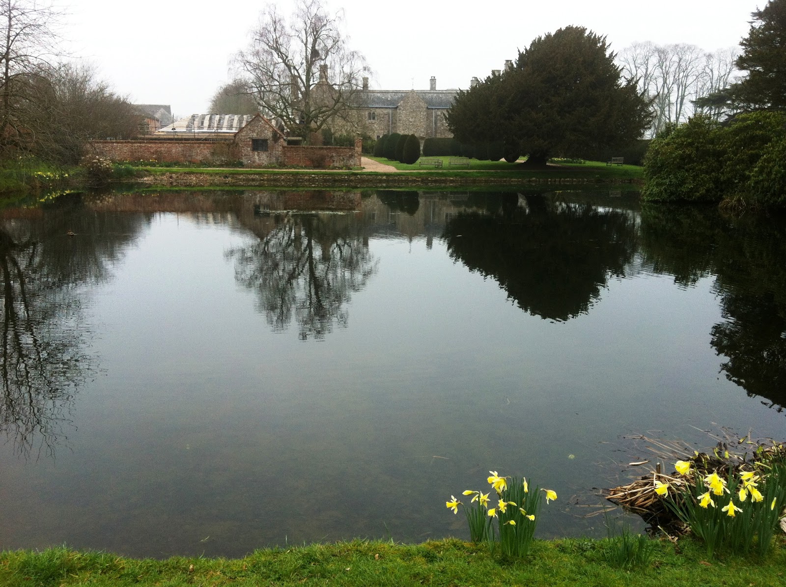
And talking of heritage assets and settings of listed buildings, this is the setting of Grade I listed Cadhay, resplendent with mediaeval fishponds in the foreground, themselves Grade II listed. What we said in our last blog would apply equally here too. A reliable supply of spring water from Straitgate, particularly during drier periods, is critical to the functioning of these ponds.


This is what was said at the Public Inquiry in 1968:
396. Cadhay is a historic house, listed as being of historic and architectual importance, and is open to the public. One of the features is the fish ponds immediately to the south of it. They are fed by the reservoir [in Cadhay Wood] and [Cadhay Wood] stream. They are not lined and water seepage takes the whole outflow. 397. It is contended that if the present water supply to the ponds were no longer sufficient to supply them they would be lost to posterity in the way in which they have existed for centuries, which would be a wanton destruction of a valuable historic monument.
The position of the spring is indicated by our arrow on ECC’s 1967 working plans below. No doubt it was in an effort to protect this water source [53] that ECC intended to leave the surrounding area unquarried.


Aggregate Industries has made no allowance yet for this spring on any plans we have seen.


Yet more for AI to subtract from its ever decreasing resource?

In 1968, the planning inspector concluded that any loss of flow to springs and streams at Cadhay "could be made good from the Straitgate lake...". [408] Without a lake, it's not exactly clear how AI could achieve that now.

Friday, 31 October 2014

Straitgate Farm – the ‘best and most versatile agricultural land’

All the land threatened at Straitgate Farm, around 80 acres, is graded under the Agricultural Land Classification as 3a, and is therefore considered the "best and most versatile agricultural land".

In 1968, the Ministry of Agriculture Fisheries and Food strongly objected to plans advanced at that time to quarry Straitgate:
The Minister is anxious to safeguard such valuable agricultural land so far as possible and I am directed to advise that in his opinion there is the strongest possible objection to the proposed development on agricultural grounds.
The application also gives every indication of being "the thin end of the wedge", and if approval were to be granted others adjoining or nearby would almost certainly be precipitated, with the greatly increased loss of further good agricultural land.
How this important natural resource is used is vital to sustainable development. This includes taking the right decisions about protecting it from inappropriate development. 
Planning authorities... should take into account the economic and other benefits of the best and most versatile agricultural land. Where significant development of agricultural land is demonstrated to be necessary, local planning authorities should seek to use areas of poorer quality land in preference to that of higher quality. 
Consultations with Natural England are required on all applications for mineral working or waste disposal if the proposed afteruse is for agriculture or where the loss of best and most versatile agricultural land agricultural land will be 20 ha or more.
Standing in one of the fields at Straitgate looking over the farm buildings towards Sidmouth Gap and East Devon AONB

Saturday, 8 February 2014

Spot the difference?

With flooding, extreme weather and climate change in the headlines again, take a look at the two quarry plans for Straitgate Farm. On the left, the one English China Clays put together in 1967 that was turned down. On the right, the one from Aggregate Industries. Spot the difference?


The most noticeable difference is a 32 acre lake on one and an ephemeral or transient pond on the other. The 1967 lake would have been formed in the void left by quarrying on the eastern side of the farm - an area no longer targeted by AI, for geological and commercial reasons. This 32 acre lake, 'Straitgate Lake', had a function. Such an important function that by the following year - in time for the Public Inquiry - it was increased to 49 acres in negotiation with Devon River Authority. Its function was to control flooding for downstream communities, by the "use of the proposed lakes for 'balancing' flood flows with appropriate settings of the proposed overflow weirs".

That was 1968, before any talk of climate change. So what does AI propose today - in the face of extreme weather and increased rainfall? A small ephemeral pond...

Is AI saying that Devon River Authority had it wrong in 1968? Or has AI conveniently 'forgotten' about flooding? 'Forgotten' what soil compaction and the removal of sand & gravel groundwater storage could do on a hill above communities with a history of flooding? Any flooding mitigation scheme planned today must be much more robust than any for 1968, much more than just a 'funnelling' of stormwater run-off down to an ephemeral pond, and overflowing down the watercourse to Cadhay.

Wednesday, 21 November 2012

Is AI ready to start groundwater monitoring yet?

Perhaps not.

As it is, the aquifers are full and there's nowhere else for the water from Straitgate to go but down the lanes and through Cadhay Bog, as these photographs this morning show.  

English China Clays considered in 1968 that after quarrying Straitgate "There would be a loss of about 90 million gallons of water storage capacity within the aquifer. However the 131 million gallons storage capacity of the lake would more than compensate that loss."

Well, any proposal now from Aggregate Industries would not include a lake, but would still include the removal of tens of millions of gallons of groundwater storage capacity.

Surely no one could be that short-sighted?

Birdcage Lane adjacent to Straitgate Farm

Birdcage Lane adjacent to Cadhay Bog

Cadhay Bog

Tuesday, 20 November 2012

Having lost once, what is AI's chance of winning next time?

click to enlarge
In 1968, the planning application to quarry Straitgate Farm by Aggregate Industries (or in those days English China Clays) was turned down. What chance will AI have if, as it says, it submits another application in early 2014?

Nationally, due to reduced demand, councils have received fewer applications for new sand and gravel quarries in recent years, but, based on data from the MPA, the chance of an application being refused is low. In 2010, 8 applications were submitted, 11 were approved (some from earlier years) and 2 appeals were allowed. No applications were refused. In 2009, 21 applications were approved, 4 were refused. In 2008, 26 were approved, 0 refused. In 2007, 28 were approved, 1 refused. Even if an application was refused, "the success rate of sand and gravel appeals is 80%" - multinationals can afford to instruct the best planning barristers and consultants. Is this why AI has the confidence to plough on regardless of all the objections, challenges and issues raised?

But AI and its consultants should pause for a moment. Most other sites are not as constrained as this one. They are often extensions to existing quarries, not isolated greenfield sites with no previous history of mineral extraction. They don't have passenger planes flying 200 metres overhead. They don't supply water to 100 people, 3 farms, wetland habitats in Ancient Woodlands, and listed mediaeval fishponds. They would not have their spoils transported 7 miles to be processed in a European designated area for wildlife conservation. They don't propose, in a period of climate change, to remove millions of tonnes of groundwater storage 100 metres in height above a town world famous for flaming tar barrels, Samuel Taylor Coleridge and flooding.

Maybe AI and its consultants think they can overcome all that. Anyway, what do local people know that a global building materials giant doesn't? Well, take water for a start. AI may get a surprise when it starts measuring groundwater levels later this month. This year's rainfall has left a water table higher than locals can remember, limiting the recoverable resource above the water table. What's more, in a field that AI has earmarked for quarrying, groundwater has actually permeated to the surface. What sort of body of water would have formed if AI had already removed the 2 metres of soils and 10 metres of pebble beds in that area? Not one that AI have planned for. Not one that would be acceptable to Exeter Airport.

Any application would be judged against the NPPF which, whilst less specific than previous guidance, remains clear on protecting listed buildings, "irreplaceable habitats" and areas at risk of flooding. New development should be "in locations and ways which reduce greenhouse gas emissions" - which should make AI stop and rethink its idea of processing any Straitgate material on Woodbury Common, if its pledges to "lead in environmental best practice" and "reducing our carbon footprint is an important part of our commitment towards sustainable construction" are to mean anything at all.

But putting all that to one side, how does AI expect to get planning permission for a brand new quarry when DCC states "5.1.4 For as long as adequate sand and gravel reserves (i.e. a minimum of seven years’ supply) continue to be present at the existing quarries, there are no grounds to allow their further extension or new quarries"? (Devon has over 16 years' supply.) Or before DCC has even had its new Minerals Plan, with its Preferred Site designations, examined by public inquiry or formally adopted - the latter due September 2014?

AI bought Straitgate Farm in 1965 from Escot, who at the time was in financial difficulty, on an understanding from a planning officer that permission would be "likely" (likely, not "certain"), not knowing the minerals' quality or quantity, or if extraction would be feasible or permissible. AI is not in any way 'owed' permission because of the length of time it has held the land. It was a speculative purchase.

Forty-six years after losing its first application, AI will be trying its luck again. However, as well as falling demand and increasing environ-mental concerns, there have been other changes since 1968. Not only does the new A30, and all its holiday traffic, now run through the site, but the population that would be impacted in Ottery St Mary and West Hill has grown substantially. The Environment Agency, Natural England, Exeter Airport, Councillors and local people are all acutely aware of the environmental impact a quarry at Straitgate Farm would have. There are robust planning arguments on which to defend a refusal to quarry Straitgate. But will 'the powers that be' agree?

Tuesday, 13 November 2012

Hanson on the other hand is mothballing quarries

Whilst AI is busily planning to dig up East Devon farmland and open a new quarry at Straitgate, Hanson is taking a different line - mothballing quarries, closing plants and laying off workers, expecting business in 2013 to be even worse.

With construction and aggregate demand still contracting, and no sign of recovery on the horizon, DCC can robustly make the case - having 9 million tonnes of sand and gravel already with planning permission, enough for 20 years at current rates - that no further provision is needed for its new Minerals Plan. In any case, for a Plan that runs as far into the future as 2031, and in order to appease mineral operators, provision can always be made for the Council to monitor production and reserves, and make site allocations when shortfalls actually become apparent, not according to a fallible long-range forecast.

After all, how many millions of tonnes would DCC have allocated needlessly if it had made the Plan in 1990, for example, when production was almost four times higher than it is today, or in 1968 at the time Straitgate was the subject of a Public Inquiry? Building techniques, materials and demands have changed, and therefore the Council needs to remain flexible, and encourage movement away from the unsustainability of primary aggregates.

'Mountains' of sand stockpiled at Blackhill Quarry, Woodbury Common SAC, SPA, SSSI, AONB

Monday, 29 October 2012

Jobs - after years of decline that argument no longer has merit

Any application to quarry Straitgate would, no doubt, use the argument of "jobs for local people" - not new jobs, as Aggregate Industries have stated there would not be any, but the safeguarding of jobs.

However, the number of jobs safeguarded would in fact be small - earlier in the year there were just nine employees at Blackhill Quarry, and at-risk Straitgate Farm itself employs four. A modern sand and gravel quarry does not support anywhere near, say, the 230 jobs offered by a tungsten mine.

The jobs argument may have had merit at the Public Inquiry in 1968 to support English China Clay's application to quarry Straitgate, Blackhill, and Colaton Raleigh, but, in those days 41 people worked at Blackhill, and a further 148 at Rockbeare.

Nationally the sand and gravel business has been in decline ever since, and "consolidation through mergers and acquisitions has seen in excess of 5,000 quarrying companies in 1960 reduced to some 200 currently" of which Tarmac, Lafarge, Aggregate Industries, RMC and Hanson now account for over 80% of output. Even over the last 10 years there has been a dramatic fall in employee numbers in sand and gravel, with the UK Minerals Yearbook reporting over 8000 employees in 2001, but under 3000 in 2010. The HSE says the "industry has difficulty attracting and recruiting staff" and "anecdotal evidence suggests an ageing workforce".

The economic ramifications of a Straitgate Quarry on the wider area would be far greater than the immediate loss of the four farm jobs, and the extract from a DCC document below highlights the "Impacts of Mineral Development on the Economy". For Ottery St Mary and surrounding communities it is clear that the "Adverse Impacts" would far outweigh any of the "Opportunities". 

Saturday, 20 October 2012

Birdstrikes - the threat is real

If DCC thinks birdstrikes are just a theoretical possibility, and that Exeter Airport is being overly protective of its flightpath and the surrounding airspace, it should think again.

The dangers of birdstrike are all too apparent from the video produced by Grass Engineering, a company in the business of making grassland around airports less attractive to birds.


But birdstrikes have an economic impact too. Even though 65% of birdstrikes cause little damage to the aircraft, "the cost of bird strikes to commercial aircraft worldwide has been estimated to be in excess of $1bn annually" - 12% for direct damage and the rest for delays and cancellations. For example, Easyjet: "The aircraft operating the inbound flight experienced a birdstrike during landing and needed to undergo a mandatory safety inspection by our engineers"; Flybe: "The Embraer 195 aircraft is now being inspected by engineers and the passengers were re-accommodated on a replacement aircraft"; Ryanair: "The majority of birdstrikes Ryanair encounter do not cause damage to their aircraft, however the commercial cost from delays is significant."

Airport "operators are required to take the necessary steps to ensure that the birdstrike risk is reduced to the lowest practicable level". If Aggregate Industries was to quarry Straitgate, it would have to do so without creating any bodies of water. 

Could AI dig a deep hole at Straitgate Farm and not expect it to fill up with water? As young children learn in the sand on the beach, it's not easy. Maybe if the hole was just restricted to the limited resource above the water table. Maybe if the hole was pumped out in perpetuity. Maybe if it was infilled with inert waste. Maybe if it stopped raining.

In 1967, when the Devon River Authority considered English China Clay's application to quarry Straitgate, it was agreed that the lake created from extraction needed to cover an area of 49 acres in order to mitigate any flooding effects on nearby communities. Local residents, farmers and no doubt the Environment Agency will question any claim by AI that it is now able to quarry Straitgate creating only an ephemeral body of water, particularly as, according to some locals, the water table is now at its highest in living memory.

ephemeral: transitory, short-lived, temporary, fleeting. Unlike a quarry, or the threat of one.

Saturday, 14 July 2012

Why is DCC not allocating Straitgate Farm as a "Preferred Site" for food production?

With food production needing to increase by 70% over the next forty years to feed the world's growing population, but demand for sand and gravel in Devon falling for the last 20 years, why is DCC proposing to sacrifice for quarrying a perfectly good dairy farm currently producing about 1 million litres of milk each year? The loss of Straitgate as a working farm would almost certainly be permanent if quarrying took place. Restoration does not work, on the basis of other sites and according to local farmers, with soils not easily consolidating and becoming productive again. Does DCC not value farmland? Some might argue that rather than helping Aggregate Industries find their next site, the County's Planners should be safeguarding and allocating more agricultural land for the security of our food supply. Otherwise, future generations may regard any decisions by DCC to remove good agricultural land from the food chain as misguided and irresponsible. 

They had their priorities right in 1968, and the Ministry of Agriculture Fisheries and Food (MAFF) was one of the more vociferous objectors to the Straitgate development, saying "The Minister is anxious to safeguard such valuable agricultural land so far as possible and I am directed to advise that in his opinion there is the strongest possible objection to the proposed development on agricultural grounds." Then, little more than 20 years on from a World War, people were perhaps more conscious that security of food supply was of national importance, but with some now predicting a global food supply crisis the issue is receiving renewed attention, and a report by the Henry Jackson Society, a leading independent think-tank, entitled ’Shocks and Disruptions: the relationship between food security and national security’ tackles the issues. 

In 1968, Straitgate Farm was regarded, as it is today, as highly productive, and in the Inspector's report from the Public Inquiry, "363) ...well-situated and climatically favoured" with land that "362) In the recent survey of agricultural land 48% of the site is categorised as Class II and the balance as Class III." What concerned MAFF was that "365) The application also gives every indication of being "the thin end of the wedge", and if approval were to be granted others adjoining or nearby would almost certainly be precipitated, with the greatly increased loss of further good agricultural land." With Aggregate Industries owning the surrounding mineral rights for thousands of acres this continues to worry local people today.

It is telling that many developers and trade bodies, such as the Mineral Products Association, have welcomed the NPPF, but on the subject of agriculture: "28. Planning policies should support economic growth in rural areas in order to create jobs and prosperity by taking a positive approach to sustainable new development. To promote a strong rural economy, local and neighbourhood plans should...promote the development and diversification of agricultural and other land-based rural businesses;" and "112. Local planning authorities should take into account the economic and other benefits of the best and most versatile agricultural land. Where significant development of agricultural land is demonstrated to be necessary, local planning authorities should seek to use areas of poorer quality land in preference to that of a higher quality."

In East Devon, high quality farmland seems to be disappearing to development at an alarming rate, and the warning from MAFF at the Public Inquiry in 1968 "363) ...that its retention is more than ever necessary to maintain production in a rapidly expanding urban society from a fast contracting acreage" will still resonate with many today. CPRE for example have recently warned: "We think that strong protection for best quality agricultural land should be an absolutely critical part of sustainable development, given that such land is a finite resource and the pressure on food and farming from wider global pressures of climate change and population growth."

Saturday, 7 July 2012

If Devon had relied on the forecasts of 1968...

How much faith should we have in forecasts? ECC (now Aggregate Industries) based their planning application to quarry over 800 acres of East Devon in 1968 on forecasts. Now in 2012 DCC has decided it needs to identify new sites for future sand and gravel quarrying, again on the basis of a forecast, which has identified a shortfall of reserves some time over the next 20 years. 

The Public Inquiry of 1968, deciding the fate of those 800 acres, heard a number of forecasts, and now with the benefit of hindsight we can see how accurate they were. ECC's submission to the Inquiry forecast that "58)...the demand from the two complexes in the year 2000 will be 2.42 million tons, made up of 1.23 for Blackhill and 1.19 for Rockbeare. This is based on a probable increase between 1966 and 1980 of 6.3% per year, following the official forecast rate of increase, and an increase of 4.5% between 1980 and the year 2000, based on official forecast population increases for the South West". The Planning Authority challenged this forecast, and thought "it should be 2.11 million tons". In the year 2000 the actual figure for Devon turned out to be only 0.8 million tonnes, or just 33% of the forecast; in 2011 it was even lower at 0.44 million tonnes or 18%. Their submission also maintained that "55) Nationally, the production of sand and gravel increased annually between 1958 and 1966, from 60 to 100 million tons, and the forecast for 1980 is 215 million tons." The actual national figure in 1980 was less than 100 million tonnes, or 45% of forecast.

Mr. Douglas Frank QC, acting for the Devon River Authority, East Devon Water Board and others, challenged these forecasts, "348) It is contended that no decision should be taken in the absence of a full investigation, to avoid another "Stanstead" case. The company have assessed future need far in excess of any normal period for making forecasts of demand, and on the theoretical basis of population estimates, which are noted for their inaccuracy. This may be inevitable in the case of development plans, or planning water resources, but they do not look 60 years ahead and population figures should not be relied on for a long period. It is equally dangerous to relate population to production in the past. 349) Who is to know what new materials or circumstances there will be in 40 years time? The official estimate is that there is not enough sand and gravel for more than 20 years. If this is right, then an alternative will have to be found, and it may be decided that it will be better to exploit the alternative than to do so much damage."

Mr. Frank's remarks proved to be the more prescient. How fortunate for Devon that the Inspector and Minister both decided that the applications to extend Blackhill, and open new sites at Colaton Raleigh and Straitgate "be not approved."

What are we to learn from this? Some may conclude that mineral companies and Planning Authorities are poor forecasters of future aggregate demand. Others, that long term forecasting is fraught with difficulty and that the Council must take the utmost care in allocating sites, preferred or with permission, before they are truly required, and before all the alternatives have been explored. At the end of 2010 the County had 9.62 million tonnes of sand and gravel reserves, over 20 years worth with the ever decreasing amounts used each year. Borrowing the Inspector's concluding remarks, which still seem relevant today, there may be "408) (p)...other land with less disadvantages, and it is not possible to say now that the need for the Straitgate site is in any way overriding. For this reason any approval would be premature, and my recommendation not to allow that application also is on that basis, apart from water supply considerations."

Wednesday, 4 July 2012

Why did Straitgate Lake increase in size?

With water being such an important issue at Straitgate we were not surprised to see a water feature of some sort on the 1967 restoration plans. What did surprise us was its size - "Straitgate Lake" was to cover 32 acres. However, between February 1967 when the plans were submitted, and 9 July 1968 when the Public Inquiry started, Straitgate Lake had "grown" to an even larger 49 acres. From the report by the Inspector to the Minister of Housing and Local Government, then the Right Honourable Anthony Greenwood MP, 8 October 1968, on the applications to quarry at Blackhill on Woodbury Common, Colaton Raleigh Common, and Straitgate Farm, it seems apparent why this happened. 

In the submission by the Devon River Authority (now the Environment Agency) the report talked about the likely effect on flooding: "342) Villages affected by flooding from those areas generally including the proposed sites are as follows:- ..... Cadhay [from] Straitgate". (Thorne Farm estate had not yet been built.) "343) Although the pattern of development of these villages renders the present flooding conditions tolerable to some extent, any increase in the frequency and extent of such flooding as a result of the company's proposals would be intolerable. 344) Control of such flooding could be effected by means of either:- (a) Additional flood relief channels and culverts within the villages, or (b) Use of the proposed lakes for "balancing" flood flows with appropriate settings of the proposed overflow weirs. 345) Agreement in principle on the second solution has been reached between the river authority's officers and the company's representatives, and only matters of detail e.g. the precise settings of the overflow weirs, remain to be finalised."

It would appear therefore that Straitgate Lake had grown from 32 to 49 acres by negotiation in order to satisfy the requirements of Devon River Authority in mitigating the flooding effects on Cadhay. This scheme was only possible because the eastern half of the site was to be quarried creating a void of sufficient proportions. Today there is no plan to quarry this area: DCC states "site appraisal found that there is likely to be a significant impact on the water environment (and consequently on biodiversity) if mineral extraction occurred in the eastern half of the S7 site", and it did not therefore form part of the Consultation. To create an area now to hold the amount of water planned in 1968 would require the extraction of approximately 1.2 million tonnes of material. We wonder how much area Aggregate Industries are now proposing to set aside to capture storm run-off to protect the residents at Thorne Farm, Cadhay, Salston and Coombelake from flooding? 

It was also clear from the Public Inquiry report that the Devon River Authority did not believe that ECC's proposals to recharge the aquifer would work. "336) As to the recharge proposals; the company seek to effect flood-control, maintain river flows, and recharge the aquifer sufficiently to compensate the losses as a result of the proposals, all by means of lakes formed from silt ponds. 337) These are incompatible objectives, and in particular such experience as exists on the artificial recharge of aquifers indicates the impracticability of the proposals in that respect. 338) This is apparent when the recharge proposals are considered in more detail. The shallow - sloping faces of the Pebble Beds intended to effect the recharge would experience silting on the lower and weed and algae growth on the upper sections, thus achieving the opposite effect. Furthermore the lakes would range in level from about their full 10 feet depth to perhaps 6 feet depth in extreme conditions. Therefore accurate control of the rate of recharge would be impossible with such wide variations, and the wide band of expected Pebble Beds when lake levels were low would encourage weed growth still further."

Something to bear in mind if Aggregate Industries think they can maintain the wetland habitats of Cadhay Bog and Cadhay Wood through recharge ponds; the ponds that would of course be contrary to the advice of Exeter Airport.

Cross section of 1967 restoration scheme

Wednesday, 27 June 2012

Straitgate Farm, the subject of a 1968 Public Inquiry

Straitgate working scheme 1967
The people of Ottery St Mary and West Hill have been through all this before, in 1968.

It was the time of Harold Wilson and The Beatles, the invasion of Czechoslovakia and the Vietnam war. On 10 July five inches of rain fell and Ottery St Mary flooded, as did other parts of East Devon. Several people drowned. By coincidence a Public Inquiry was sitting on the same day at County Hall deciding the fate of Straitgate Farm.

We were interested to see if there was any more behind the refusal of the planning application of 1967, and it transpires that the Planning Authority was in fact in favour of the proposal to quarry Straitgate Farm. However the application was called in to be decided by the Minister, together with extensions to Blackhill and a new quarry on Colaton Raleigh Common, and a Public Inquiry was held in view of representations made by the East Devon Water Board and Devon River Authority on the adverse effects of the proposals on water supplies in the area. From the Express & Echo of 9 July 1968: "The inquiry which is being held at County Hall is expected to last a fortnight. Its outcome may decide the future of quarrying for sand and gravel in the area for many years. It concerns proposals by E.C.C. Quarries Ltd., who have existing workings at Rockbeare Quarry near Ottery St Mary, and Blackhill Quarry near Woodbury. They are seeking permission to work 134 acres at Straitgate Farm, a 325 acre extension at Blackhill and a new 385 acre quarry on Colaton Raleigh Common. Bodies represented at the inquiry include the National Parks Commission, the Ministry of Agriculture, the Nature Conservancy, Devon County Council, Devon River Authority, the East Devon Water Board, the urban councils of Ottery St. Mary, Budleigh Salterton, and Exmouth and St. Thomas Rural Council". West Hill Ratepayers Association raised funds for a barrister to represent them at the Inquiry. Long petitions from local residents were sent to the Council opposing the application.

The story was followed virtually every day in the Express & Echo and some of the articles are below. The Ministry of Agriculture Fisheries and Food strongly objected to the Straitgate proposal and said "The quality of land is such that in a rapidly expanding urban society its retention is more than ever necessary to maintain production from a fast contracting acreage." which seems as relevant today as it did 44 years ago. "Mr Douglas Franks Q.C. for the Devon River Authority, East Devon Water Board, and others, commented today that they could not get away from the basic fact this proposal was introducing an "obnoxious industry" into an area of magnificent countryside." In the 10 July article ECC claimed to have appreciated the increased risk of flooding quarrying might cause and had proposed flood prevention lakes with overflow weirs to meet the objection of the Devon Rivers Authority from the point of view of the increased danger of flooding.

Straitgate restoration scheme 1967
Aggregate Industries in 2012 have not yet released plans of how they intend to quarry the site and mitigate the flood risk, but in 1967 the plans show how ECC intended to do it. (We are grateful to the Minerals Officer for recovering these plans from the DCC archives.) The eastern side was to be worked first and the material processed at Rockbeare. Processing plant was then to be built at Straitgate in the resultant void, with accompanying silt ponds, and the rest of the site worked. Straitgate Farmhouse was to be demolished. The company estimated the resource to be 20 million tonnes with work expected to start in the mid 1980s. The imaginative, and if we are cynical, somewhat unlikely restoration scheme proposed a 32 acre lake (with beach, boathouse and landing stage!) for flood mitigation with an overflow weir sending water running down through Cadhay Wood. ECC were "agreeable to paying a capital sum now to the Devon Rivers Authority, discounted over 50 years, in order to set up a sinking fund to provide for the cost of maintenance of these works after the company had vacated the land". ECC added "Some domestic wells at some properties in the Straitgate area might suffer a lower yield or dry up altogether as a result of the quarry development. But it would not be expensive to make mains connections to affected properties."

After the Inquiry the Inspector said: "The company has tended to under-estimate the importance of the natural storage capacity of the aquifer.... the Straitgate loss would be likely to exceed the company's estimate." (Sounds familiar!) The Inspector concluded that regardless of the "water supply considerations" with reference to Straitgate "any approval would be premature". The Minister accepted the Inspector's conclusions.

Express & Echo 1968: 
June  "Ottery to fight plan for minerals excavations"
9 July "Quarry plan for Common is probed"
9 July "A nibble is no good Q.C. tells quarry inquiry"
10 July "Quarry site to be screened by 15ft. trees"
11 July "Quarries provide jobs and trade inquiry told"
12 July "Quarry site could become playground"
18 July "Farm should not be taken for gravel"