According to Aggregate Industries, 159,000 cubic metres of overburden material from above the sand and gravel resource would need to be stored elsewhere on site in 5m high mounds if Straitgate Farm were to be quarried, material that would in time need to be restored.
The issue of soil storage is important. The Devon Minerals Plan states "a proposal affecting the best and most versatile land should provide for the restoration of the land to its former quality." Natural England had asked for more information on the storage of subsoils, information that was not supplied.
The different categories of retained soils must be stored like-on-like. Overburden can only be stored on overburden. Topsoils and subsoils S1 and S2 would first need to be removed from those storage areas, and stored elsewhere.
At the same time, in line with proposed conditions from the Environment Agency, "no working shall be undertaken below the ‘Maximum Winter Water Table (MWWT) grid’" or "closer to the contemporaneous measured groundwater level than 1m."
We have recently posted that – in the middle of summer – a new spring was discovered exactly where Aggregate Industries wants to stockpile 82,000 cubic metres of overburden in the area designated OB1. The new spring is close to the borehole location SG21/90 where groundwater was recorded just 1.26m below the ground surface in June 1990.

However, there’s clearly a further problem. The geological plan shows groundwater close to the surface in the other area designated for overburden storage, OB2, where Aggregate Industries wants to stockpile another 77,000 cubic metres of overburden. Borehole SG12/90 recorded groundwater at 1.59m below the surface – again in the middle of summer, in June 1990.
The EA has stipulated that these 1990 groundwater levels should inform the application.
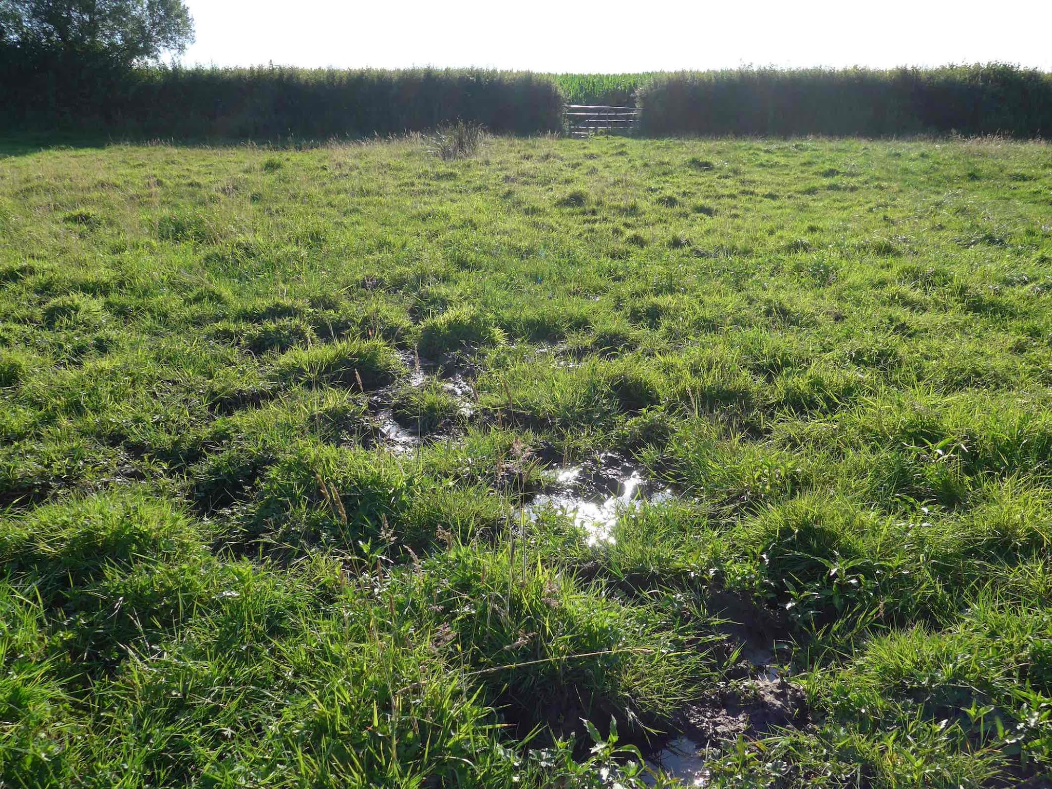
There is clearly an unmistakable pattern beyond the eastern boundary of the extraction area, along the geological fault line, exactly where Aggregate Industries wants to store overburden.

This is a photograph of another spring, issuing to the north of the planning red line boundary as indicated at the top of the above plan, taken just last week.
So, where could overburden be stored where the removal of topsoils plus subsoils would not breach the maximum water table, where groundwater would be at least 1m below any working? Given that no groundwater monitoring has been carried out in the proposed overburden storage areas, no one knows.